
01The Gate Comes Ahead
How does hiking work in China, and are permits needed?
Before asking how hard a Chinese trail is, ask who allows the walk. Four doors, loosest to tightest: the free city hill reached by metro; the ticketed park where the path is a stone staircase; the mountain with two entrances at two prices; the open land with no gate at all where a county filing or a licensed guide may still be required; and the route that is simply shut for a time. Inside the gate the path is usually built. Outside it, the path is earth, and so is the paperwork.
Why the door decides everything. It sets the price, the surface underfoot, whether the walk may be done alone, and whether a foreign passport changes the answer. Of the routes on this page, about half pass through a paying scenic area (景区) at some point, by the survey's count. Some need a filing or a licensed guide even though nothing bars the way. Some are closed or banned outright. Many are open to any visitor with a passport and nothing else.
What is on this page. Over a hundred routes in two dozen provinces, and the object is the route, not the mountain: one mountain can carry three of them, one route can cross three protected areas. They sort into six kinds, which is also the order of the page: day walks, light multi-day routes with a bed at the end of each day, camping routes, pilgrim circuits, routes on grass, sand, coast and forest, and a few that exist here as warnings.
The awareness gap is the second thing to know. A few routes are genuinely known abroad: Zhangjiajie (张家界), Huashan (华山), Yangshuo (阳朔), the Longji (龙脊梯田) terraces, Taishan (泰山) and Tiger Leaping Gorge, by the survey's scoring of English-language coverage. Everything the Chinese outdoor world argues about, the Wusun (乌孙古道) road, Genie (格聂), Langta (狼塔), Karajun (喀拉峻), scores at or near zero in the same corpus. That asymmetry is the reason this page exists: the well-known few are well covered in English already, and the useful work is the rest.
How to read a card. Every route carries a start and end coordinate, the open status with the office that issued it, the entry and shuttle (观光车) arrangements, the season window, what a foreign passport can and cannot do, and the accidents on record. Rules and closures move; the page says which office to check.
02Why Mountains Are Staircases
Why are Chinese mountain trails made of stone steps?
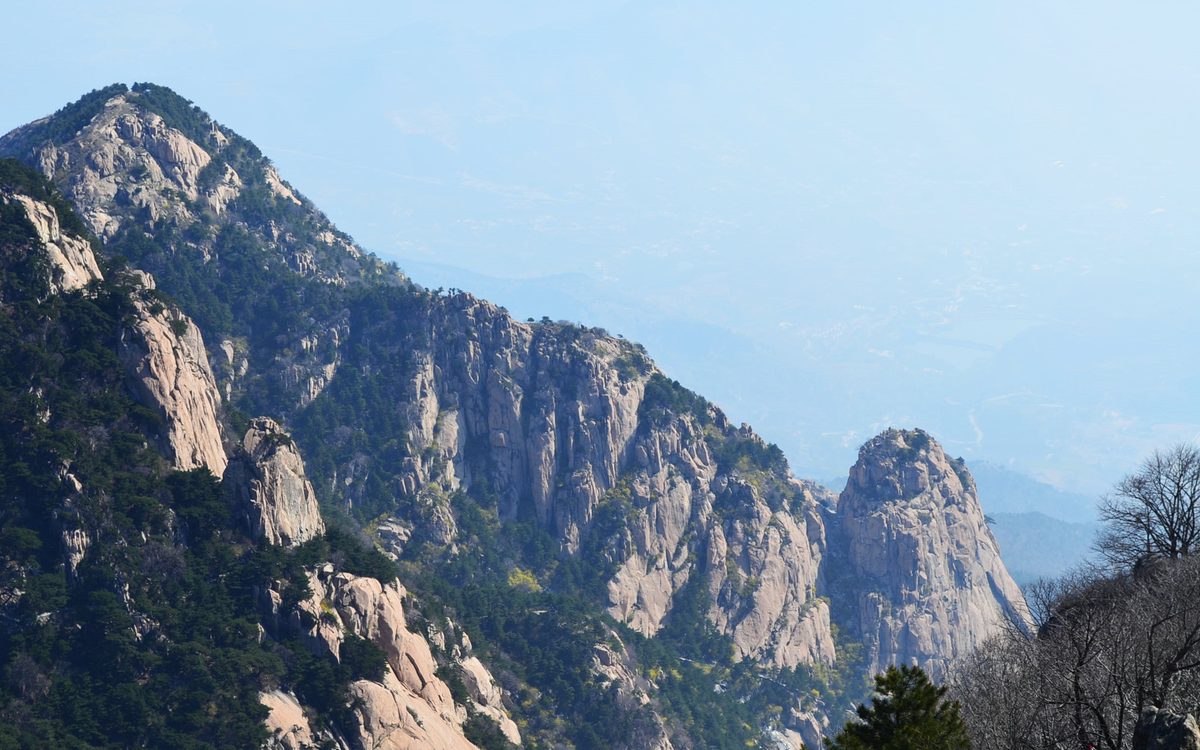
A foreign walker's opening surprise in China is the surface. On the well-known mountains the path is not a trail but a flight of stone steps, thousands of them, laid end to end from the gate to the summit, with tea sellers on the landings and a cable car (索道) running overhead.
Where the steps come from. Many of the old mountains were pilgrim routes and incense roads before they were scenic areas (景区): the stairs were cut so that worshippers, porters and sedan chairs could get up, and the scenic area inherited them, widened them and put a handrail on. The result is that the effort is real but the navigation is nil. Taishan (泰山) climbs one thousand three hundred and fifty metres in nine and a half kilometres and every metre of it is paved, by the survey's card. Emeishan (峨眉山) is twenty-eight kilometres of steps from the temple at the foot to the summit. The west slope of Changbaishan (长白山) is a stair of one thousand four hundred and forty-two; Nanwutai (南五台) outside Xi'an (西安) counts one thousand eight hundred and eighty-eight to its terrace.
What that means for the legs. Stone steps punish knees on the way down far more than earth does, and they set a rhythm that cannot be changed: no switchbacks to ease the grade, no soft ground. Walkers who are comfortable with twenty kilometres of forest trail often find a nine-kilometre staircase harder. The cable car is the standard answer, and many walkers take it down; Taishan has a descent cable car, and on Huashan (华山) two of the three ridges have one.
The exception that proves it. Huashan keeps the chains: the granite ridges above the north peak are climbed on iron chains set into the rock, with the plank walk on the south face bolted to a cliff, and the survey notes the walk is now a busy attraction with two harness points. Where the rock refuses a staircase, China builds a via ferrata instead. Earth paths begin where the gate ends, which is the subject of much of the rest of this page.
A practical note. On a staircase mountain, poles and knee support matter more than boots, and the crowd matters more than either. The stairs are also why the night climb works: Taishan at two in the morning is a line of head torches going up a lit staircase, and the survey rates it a reliable sunrise walk in the country for a new visitor.
03The Free Hills in Eight Cities
Where can a visitor hike near Beijing, Shanghai, Guangzhou, Shenzhen, Chengdu, Hangzhou, Xi'an and Kunming?
The walk many foreign visitors will actually do is the one they can reach by metro on a free morning. Eight gateway cities have twenty-four of them on this page, and the pattern repeats: a city forest park, free or nearly free, open from dawn, with a summit view of the skyline and a noodle shop at the bottom.
What they cost. Baiyun Mountain (白云山), the city hill of Guangzhou (广州) in Guangdong (广东), charges a small fee and stays open around the clock, by the survey's card. Shenzhen (深圳)'s Wutong Mountain (梧桐山) is free and is the high point of the city, with Hong Kong's hills visible across the water. Huolu Mountain (火炉山) in the same city, Longquan Mountain (龙泉山) in Chengdu (成都), the Ten-Mile Langdang ridge above West Lake (西湖) in Hangzhou (杭州) and Changchong Mountain (长虫山) in Kunming (昆明) are all free. Where a park does charge, it is usually a modest fee, and the shuttle (观光车) bus inside is often compulsory.
How to get there. Huolu Mountain sits at the end of a Guangzhou metro line. Wutong Mountain, Longquan Mountain, the West Lake ridge, Kunming's Western Hills and Changchong Mountain are all bus or metro plus a short walk. The cards give the line and the stop, because on a city hill the transport is the plan and the walking takes care of itself.
What they are good for. Half a day, a view, and an opening read of how Chinese people use a mountain: retirees on the stairs at six in the morning, singing groups at the pavilions, families with thermos flasks, and on Sunday a line at the summit marker. The Beijing three, the Jingxi caravan road (京西古道) with hoof-worn stone, the Baihe gorge (白河峡谷), and the Miaofeng (妙峰山) incense road, are the ones that come with history attached.
The catches. Some hills close their gates in the afternoon to new entrants, and Paiya Mountain (排牙山) in Shenzhen has scrambling sections that need hands, so it rates a step above an easy walk. Some are closed for part of the year for fire season. Beijing's Lingshan (灵山) and Haituo Mountain (海坨山) are partly managed: one ridge is open and the main summit is not. And the free hills are where many urban rescue call-outs happen, because they feel like parks and are not.
04Two Doors, Two Prices
Why do Chinese mountains have two entrances at two different prices?
On a lot of Chinese mountains there is more than one way in, and the doors charge different money for the same ridge. Knowing which door the locals use is worth more than any gear advice on this page.
Wugongshan (武功山) is the clearest case. The grass ridge in Jiangxi (江西) that Chinese walkers rate for its sunrise can be entered at the front gate, where a gate fee applies, or from Shenzi village, where a small village fee allows the same traverse. Both are legal. The village route is longer and unpaved, which is exactly what the two-day traverse wants.
Tiger Leaping Gorge splits the other way. Reports differ on whether the High Trail along the north wall carries a charge; the paid parts are the viewing platform above the upper gorge and the managed staircases down to the water. The gorge is where the distinction matters, because the unmanaged paths at the bottom are where accidents have happened, while the signed High Trail above has no comparable record.
Provinces charge separately. Tiantangzhai (天堂寨) straddles Anhui and Hubei (湖北) and the two entrances price the same peak differently. The Huihang (徽杭古道) ancient road runs from Anhui into Zhejiang and each end sells its own entry.
The shuttle (观光车) is the hidden cost. In many parks the gate fee is just the opening payment: Daming Mountain (大明山) in Zhejiang has a free gate and a compulsory shuttle; Nanwutai (南五台) charges for the return bus; Zhangjiajie (张家界) sells a multi-day combined pass which is the sensible way to use the park. Cards list the entry and the shuttle separately for this reason.
How to use this. Before planning, look at the card's gate line and ask three questions. Is there a village entrance. Is the shuttle compulsory. Does the pass last more than one day. The answers change the cost of a Wugongshan weekend considerably, and they decide whether the walk is on earth or on pavement.
05The Six Already Known
Which Chinese hikes are well known outside China?
Six walks on this page carry real recognition outside China, and each got it a different way. They are worth knowing partly because they are good and partly because knowing why they are well known shows what the rest are missing.
Zhangjiajie (张家界), by film. The quartzite pillars of the Wulingyuan (武陵源) park scored very high in the survey's English-coverage check, and the reason is a film: the floating mountains of Avatar were drawn from them. Inside the park the walking is genuine, the Golden Whip Stream and the Yuanjiajie and Tianzi ridges linking up to about eighteen kilometres, but so is the crowd.
Huashan (华山), by photograph. The plank walk bolted to the south face is a widely circulated image of China on the English internet. The mountain behind it is a real traverse: five peaks, granite, iron chains, eighteen to twenty-three kilometres with up to two thousand four hundred metres of climbing by the survey's card, and the plank walk itself is a short detour with a harness and a line.
Yangshuo (阳朔) and the Longji (龙脊梯田) terraces, by banknote. The karst reach of the Li River (漓江) is printed on a banknote, and the Yulong River (遇龙河) walk beside it is sixteen flat kilometres past the same scenery. The Longji rice terraces two hours away are a fifteen-kilometre walk on six-hundred-year-old field embankments between Zhuang (壮族) and Red Yao villages, by the card.
Taishan (泰山), by ritual. A much climbed mountain in China and a reliable sunrise: up the lit staircase through the night, a cold wait at the top, and a cable car (索道) down.
Tiger Leaping Gorge, by backpacker history. Halfway House on the High Trail has been a stop for foreign self-organised walkers since the nineteen nineties, and the survey notes more English than Chinese is heard on its balcony. It remains a good opening multi-day walk in China for a foreign visitor: two days, a bed each night, no permit.
Pudacuo (普达措), by the word national park (国家公园). Six kilometres of boardwalk (栈道) at three thousand six hundred metres beside two lakes in Shangri-La (香格里拉). It is on this list because the English name travels, not because the walking is hard.
What the six have in common. Every one of them is inside a gate, signed, and walkable without a word of Chinese. That is also their ceiling: the routes that Chinese walkers argue about start where these end.
06Sleeping in Villages
Which multi-day hikes in China allow a night in a village instead of a tent?
Good walking in China for a visitor with a week is the kind where a day pack is carried and the night is spent in a village. Twenty-one routes on this page work that way, and they are the bridge between the ticketed staircase and the tent.
Tiger Leaping Gorge, two days. Twenty-two kilometres along a shelf two thousand metres above the Jinsha (金沙) River, with Jade Dragon (玉龙雪山) and Haba (哈巴雪山) snow mountains facing each other across it. Guesthouses at Naxi (纳西族) Family, the Tea Horse, Halfway and Tina's; beds in the guesthouses. No permit, yellow arrows on the rocks, and a leading choice on this page for an opening multi-day walk.
Yubeng (雨崩), three days. The Tibetan village under Kawagarbo (卡瓦格博) is reached on foot or by off-road taxi, and some of its branches are open while others are not: the Sacred Waterfall branch is the usual one, and the others have been closed by county departments. The status of each branch is worth checking before departure; accidents have occurred on the closed paths.
Wugongshan (武功山), two days on grass. Waist-high alpine meadow along a ridge, the sunrise that Chinese walkers rate highly in the south, forty-five kilometres end to end, tents or the huts. Summer thunderstorms are the real hazard.
Kanas (喀纳斯), four days in Xinjiang (新疆). Jiadengyu to Hemu (禾木) to the Black Lake to Kanas Lake, about seventy kilometres, sleeping in guesthouses and felt tents, open roughly June to August, by the card. The park runs five marked routes; the Baihaba (白哈巴) section needs a border permit (边境证).
Wutaishan (五台山), the great circuit. Fifty-two kilometres over five flat summits at about three thousand metres, walked clockwise by monks and lay pilgrims together, with temple dormitory beds. Open in the warm season, shut in winter.
Yading (亚丁) and Dangling (党岭). The three sacred lakes at Yading are a day or two of boardwalk (栈道) and horse track under three six-thousand-metre peaks; Dangling in Danba (丹巴) opens between late April and mid-November and gives a lake and a camp at the top of a short valley.
What they share. A bed, a hot meal, no tent, and a gate somewhere on the route. What they ask is two to four days and the willingness to book in season.
07No Gate, But Ask Ahead
Is permission needed to hike in Sichuan and Yunnan when there is no entry gate?
Twenty-five routes on this page need a tent, and many of them sit on land with nothing to stop a walker entering. What stops a walker is paperwork: a protected area that requires a filing, a county that requires a licensed guide, or a commercial operator that will not take an unregistered walker. The absence of a gate is not the absence of a rule.
The Gongga (贡嘎) circuit is the model. Eighty kilometres over five or six days around the seven-thousand-five-hundred-metre peak of Minya Konka (贡嘎山) in Sichuan (四川), no gate anywhere, and a filing with the national protected area before the start, by the survey's card. Commercial groups run it. The walking is meadow and moraine at up to four thousand nine hundred metres and the hazard is altitude, not navigation.
The Rock route asks for more. Fifty to seventy kilometres from Muli (木里) in Liangshan prefecture, Sichuan, to Yading (亚丁), following the path the botanist Joseph Rock (约瑟夫·洛克) travelled in the nineteen twenties. It needs a filing, a licensed guide and a horse team, by the card, and it carries a long accident list. The classic old variant has been closed and the current line is the shorter one.
Changping to Bipeng, the one with a direction. Thirty-six kilometres under the north face of the six-thousand-two-hundred-and-fifty-metre Yaomei (幺妹峰) peak in Aba. Walked from Changping it is open with a filing; walked in reverse it is not approved, and accidents have occurred on reverse attempts.
Meili (梅里雪山) north slope and the village fee. The Yagong to Pojun circuit of about fifty kilometres is run by the village collective with a compulsory guide, because the route sits in the core of the Three Parallel Rivers world heritage area.
Nianqing East (念青东), the long one. The Qutong (曲通) line in Bomi (波密) county runs one hundred and ten to one hundred and forty-four kilometres over four passes above five thousand metres in eight to ten days, and is open to a foreign passport without a Tibet (西藏) travel permit because Bomi is not a border county; the guide and the logistics are still the practical gate.
The rescue clause. Sichuan and several other provinces now charge for rescues from unapproved entry, and the cards carry the provincial wording where it exists. It is the cheapest reason to file: the filing is free and the rescue is not.
Practical shape. For all of these the sequence is the same. Read the card's status line, contact the county or protected-area office it names, join an operator if the card says a guide is compulsory, and treat the season window as a hard limit.
08Tibet and the Paperwork
What permits does a foreign visitor need to trek in Tibet and border areas?
Sixteen routes on this page need a document before they need a rucksack. Eleven of them are in Tibet (西藏), and the rest are in border prefectures of Xinjiang (新疆), Yunnan (云南) and Qinghai (青海). The rules are administered locally and they change, so this section describes the shape of the process and promises no outcome.
What Tibet asks. A foreign visitor travelling in Tibet arranges the visit through a travel agency and travels with a guide; the agency handles the paperwork. Border counties add further conditions. Walking without a guide in these places is not a realistic plan for a foreign passport, and the cards say so plainly.
What Xinjiang asks. The Ili and Aksu mountain districts are border management areas, and the permit question there is separate from whether the route is open at all. Baihaba (白哈巴) on the Kanas (喀纳斯) circuit needs a border permit (边境证) even though the rest of the route does not.
Where a passport is enough. Much of Sichuan (四川) west of Chengdu (成都), including Gongga (贡嘎), Yading (亚丁), Siguniang (四姑娘山) and Genie (格聂), has no Tibet-permit requirement, by the cards. Bomi (波密) in Tibet, for the Nianqing East (念青东) route, is not a border county. Qinghai's Amnye Machen (阿尼玛卿) circuit is handled as an agency filing, by its card.
The pilgrim circuits and their direction. Kailash is walked clockwise by Buddhists and Hindus and counter-clockwise by Bon practitioners; the Bon sacred mountain at Bonri (苯日神山) near Nyingchi is walked counter-clockwise for the same reason. The Meili (梅里雪山) outer circuit takes ten to thirteen days over one hundred and eighty-five kilometres and is walked clockwise. Pilgrims prostrating full-length along the road are a normal sight on all of them; walkers pass on the outside and do not photograph faces without asking.
The honest caveat. Document rules in these regions change more than once a year. Check again in the month of travel, and build a plan that survives a no.
09The Doors That Shut
Which well-known Chinese trekking routes have been closed?
Eleven routes on this page were walkable a few years ago and are not now. The closures are not one policy but a run of separate county and protected-area decisions, and together they have taken many of the long classic traverses out of play.
Xinjiang (新疆) has closed several of its great roads. The Wusun (乌孙古道) ancient road, the Xiate (夏塔古道) ancient road and the North Tianshan line have been closed under district bans on mountain trekking issued by Tekes (特克斯) and Zhaosu (昭苏) counties, and the Langta (狼塔) C route in Hutubi (呼图壁) has been closed and the closure restated. These were the backbone of Chinese long-distance walking.
Sichuan (四川) closed two core zones. Genie (格聂) has been off limits under an open-ended ban on crossing the core and buffer of the Haizishan protected area. Qizanggou (七藏沟) was closed by a Songpan (松潘) county notice.
Tibet (西藏) closed the east face of Everest. The Kama valley (嘎玛沟) has been shut by the local branch of the Qomolangma protected area, which bars trekking in the core and buffer zones. The route is on this page as a closed card with its history intact, alongside the seasonal warning card for the monsoon (季风) window.
And four more, for four different reasons. Xiaowutai (小五台) in Hebei (河北) is closed year-round as a protected core zone. Chuandingding (船底顶) in Guangdong (广东) has been off limits under a lizard protection area. Jiudingshan (九顶山) in Sichuan is closed until further notice. Nianbaoyuze (年保玉则) in Qinghai (青海) has been shut for ecological recovery, and is often confused with Lianbaoyeze (莲宝叶则) on the Sichuan side, which is an open scenic area (景区).
What drove it. Two things moved at once. Protected-area law tightened, and the penalty for entering a core zone rose sharply. At the same time the accident and rescue bills grew with the sport's popularity. The result is a boundary that now moves faster than guidebooks do, which is why every card on this page names the issuing office and the date.
10The Eight That Kill
Which Chinese hiking routes are banned, and why?
A few routes appear on this page as warnings alone. They are listed because they are well known in Chinese outdoor circles and because a visitor who searches for them in English will find scenery and not the ban.
Aotai (鳌太线) is the one to understand. The forty-eight kilometre traverse along the main ridge of the Qinling (秦岭), between Ao Mountain and Taibai (太白山), runs above three thousand metres with no supply point and a stone-field plateau where fog removes every reference. It has a long accident record, and the route has been banned by the protected-area administration and the county governments, with fines for entering past the stations.
The empty quarters. Changtang (羌塘) in northern Tibet (西藏), Hoh Xil (可可西里) in Qinghai (青海) and Lop Nur (罗布泊) in Xinjiang (新疆) are hundreds of kilometres of uninhabited high desert, closed to entry. The Kama valley (嘎玛沟) in the monsoon (季风) carries its own card because the season, not the route, is the danger there: a snowstorm in early October once trapped close to a thousand walkers.
Heizhugou (黑竹沟), the local legend. The undeveloped core of this Sichuan (四川) gorge, known in China as the Bermuda of the Sichuan basin for its disappearances, is closed; the developed section is a normal day walk and stays open.
Why they are here at all. A warning that is not findable is not a warning. Each card leads with the ban, names the office and the year, lists the accidents with sources, and gives an easier alternative. None of them gives route directions.
11Grass, Sand, Coast and Forest
Where can a visitor walk on grassland, desert, coast and forest in China?
Fifteen routes on this page are not about mountains at all, and they follow different rules: on grassland the gate is a herder's fence, in the desert it is a vehicle, on the coast it is the tide, and in the forest it is the protected-area boundary.
Grassland. Hulunbuir (呼伦贝尔) in Inner Mongolia (内蒙古) is walked along the Mergel (莫尔格勒河) River, the winding watercourse that Lao She praised, in stages of five to fifteen kilometres. Ulan Butong (乌兰布统) on the old Qing (清), 17th to early 20th century imperial hunting ground gives birch woods and low hills over two days. Nalati (那拉提) and Kuerdening (库尔德宁) in Ili are high river-valley grasslands with spruce forest, open in season with a fee and a compulsory shuttle (观光车). Karajun (喀拉峻) is the one Chinese walkers rate very highly, a twenty-kilometre traverse from Qiongkushitai (琼库什台), and it stays open inside the scenic area (景区) even though the surrounding district bans trekking outside developed areas.
Desert. Kubuqi (库布齐) runs about twenty-two kilometres over one or two days and is free to walk, with a fee just where it touches the resort. Badain Jaran (巴丹吉林) needs a four-wheel-drive and a guide as a practical matter and leads to Bilutu (必鲁图峰), a very high sand peak by the card's claim, and a lake that stays pink all year. Tengger (腾格里) is the one to be honest about: the five-lake traverse of about fifty kilometres has the worst word of mouth of anything on this page, with the top comment under a popular video calling it fifty kilometres of identical dunes and others describing quitting halfway. It is here because people ask about it.
Coast. The Dongxichong (东西冲) traverse in Shenzhen (深圳) is six to seven and a half kilometres of rock scrambling with fixed ropes along a coastline a National Geographic list rated among China's top ten, and the tide decides when the start is possible. Weizhou Island (涠洲岛) off Beihai (北海) is a volcanic island loop past an eighteen-fifties French church; Pingtan (平潭) in Fujian (福建) walks a wind-turbine coast sixty-eight nautical miles from Taiwan, with blue-tears plankton on spring nights.
Forest. Shennongjia (神农架) is the roof of central China at three thousand one hundred metres with golden monkeys in the protected area. Arxan (阿尔山) in Inner Mongolia has a heart-shaped crater lake, a river that does not freeze, and a lava field. Mohe (漠河)'s Arctic Village walks the Heilongjiang (黑龙江) bank at fifty-three degrees north, the northernmost settlement in the country, with Russia on the far shore.
The common thread. None of these needs mountain fitness. All of them need the season right, and four of them close for part of the year.
12PreeChina, and What It Is Not
What does PreeChina arrange for hiking in China?
- A Chinese walk needs three things arranged in advance: the door, the bed and the season. Those are what we do.
- The four kinds of trip. - An afternoon. A city hill in whichever gateway city is the arrival point, reached by metro, free or modest in cost, back in time for dinner. Twenty-four of them on this page. - An opening multi-day walk. Tiger Leaping Gorge in two days with a bed each night, no permit, no tent. Wugongshan (武功山), Kanas (喀纳斯) or the Wutaishan (五台山) circuit for the same shape elsewhere. - A camping route with a filing. Gongga (贡嘎), the Rock route, Siguniang (四姑娘山), Meili (梅里雪山) north slope. We file with the county or protected area, arrange the operator where a licensed guide is compulsory, and build in the weather day. - A permit trip. Kailash (冈仁波齐), Motuo (墨脱), Lhozhag (洛扎), Amnye Machen (阿尼玛卿). The agency and guide are arranged at the start and the itinerary is written to match the permit, because the permit is the constraint.
- What we check the week of travel. The open status with the office named on the card, the entry and shuttle (观光车) arrangements, the cap where one exists, the season window, and whether the branch wanted is the branch that is open. Yubeng (雨崩) is the standing example: the village is open and three of its four paths are not.
- What this page is not. It is not the parks page, which covers what happens inside the gate. It is not the Great Wall page; two wall walks appear here and the wall itself is there. It is not mountaineering: Haba (哈巴雪山), Yuzhu and Muztagh Ata are summits, not walks, and appear where a route passes their base camp. It does not cover Hong Kong's trails, which are in an appendix, or routes outside China.
- And it takes no view on the things that gather around trails. Which route is lovely, whether a mountain is sacred and to whom, whether a closure was right. We give the distance, the ascent, the office that issued the ban, and the date we checked. On the routes in block ten we say plainly that they are banned, and we do not print directions.