A field guide students use on the Great Wall near Beijing, so they can learn on the wall without a tour guide. Six stations cover the Mutianyu section (慕田峪), and four more cover Badaling (八达岭) for groups that go there or want to compare. Students find out four things: how steep the wall is, how a warning travelled along it, why it was built here, and what the West built that looks like it. This page shows the facts and diagrams for every station and one station in full; the tasks and teacher pages are in the full guide.
Years 6 to 8Mutianyu and Badaling10 stationsWritten for the Western Australian Curriculum
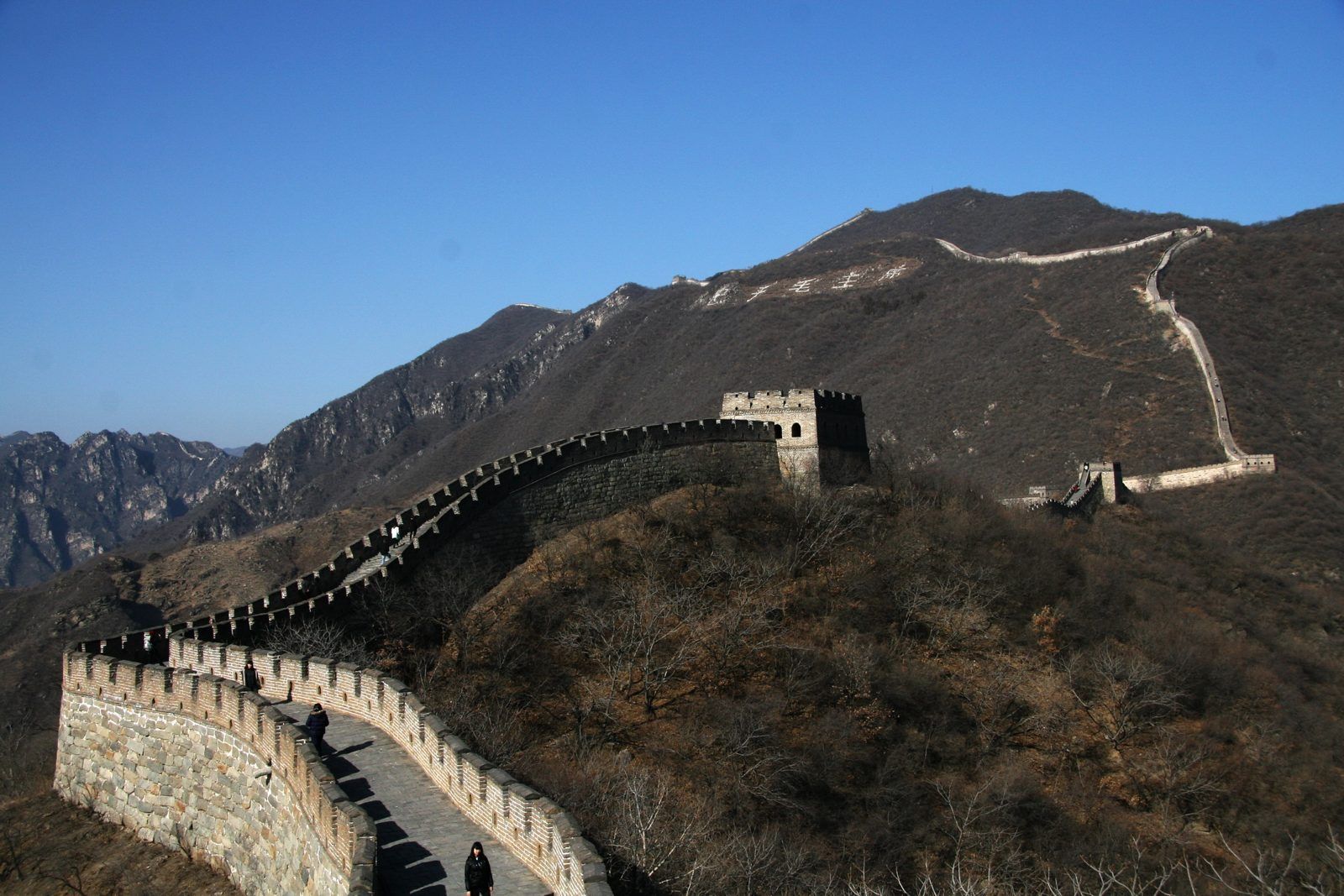
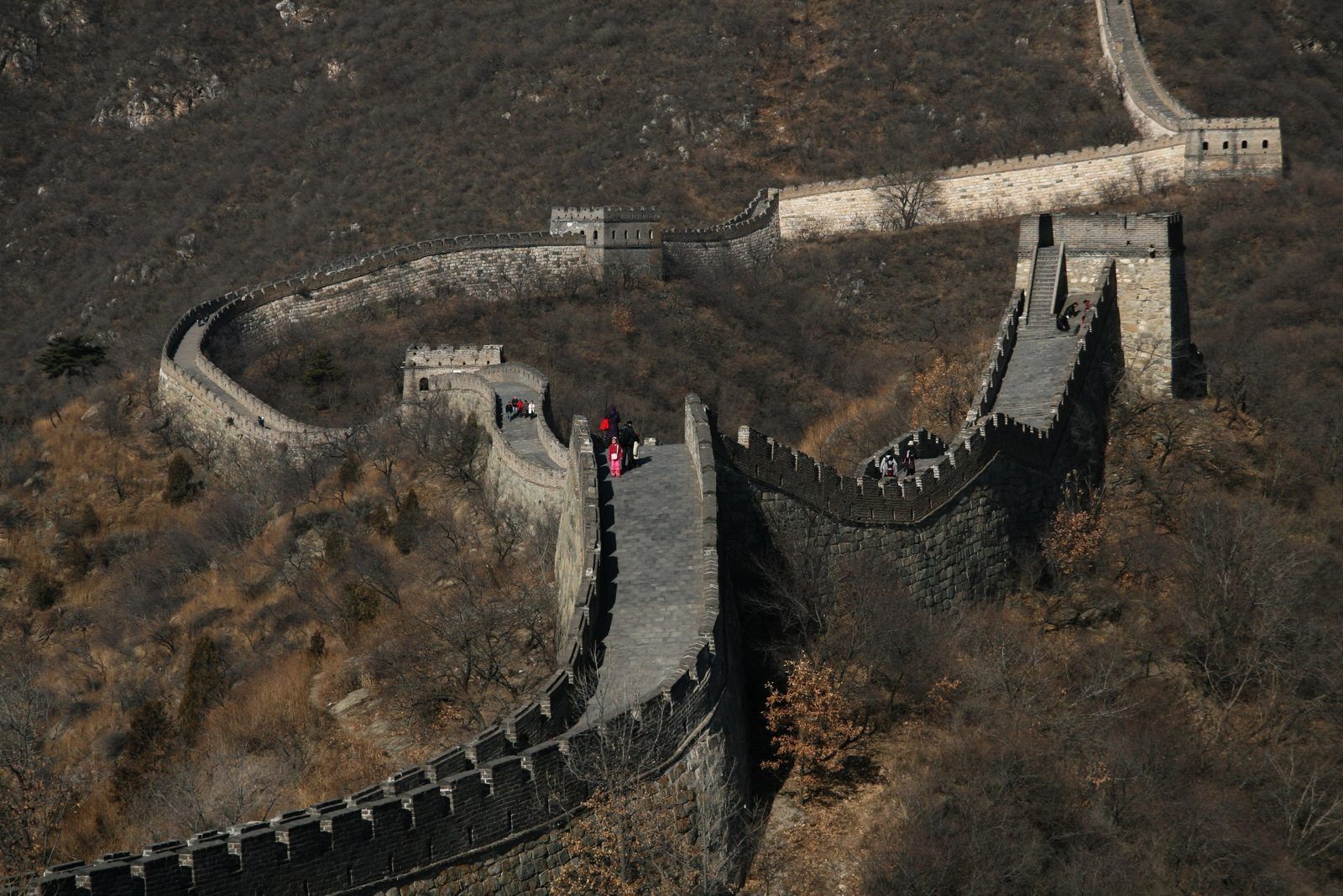
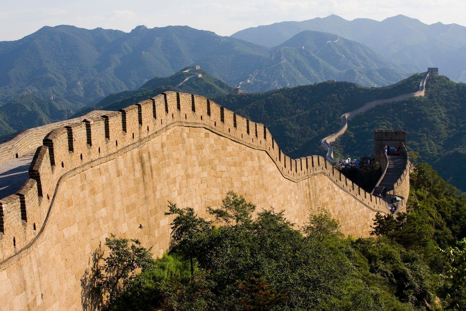
The wall at Mutianyu follows the ridge line · Photo: licensed stock image
The Big Question
What is a wall for: keeping people out, keeping people in, or showing who is in charge?
How steep is it? Students feel how hard it is to climb, then work out how hard it was to build and to patrol.
How did a warning travel? How a watchtower is built, and how soldiers sent a message along the wall with smoke, fire and cannon.
Why build it here? Horse riders from the grasslands to the north, a mountain range, and the farmland and capital to the south.
Has the West built anything like it? Hadrian's Wall, the castles of medieval Europe, England's beacon chain and a gun battery on Rottnest Island.
Before You Go
What students already know
Ancient China (Year 7 History). The first emperor, Qin Shi Huang, joined older walls together. The wall near Beijing is much younger: most of it was built or rebuilt under the Ming dynasty (1368–1644).
The Mongols (Year 8 History, where taught). In 1368 the Ming drove the Mongol Yuan dynasty out of China, and the Mongols went back to the steppe north of these mountains. The soldiers on these towers were watching for Mongol riders.
Rocks (Year 8 Science). The wall is built of stone and brick, and students identify the rock in the lower courses.
Mountains (Year 8 Geography). The wall follows the tops of ridges. Before climbing, students guess where they would build a wall if they had to.
Practical notes
Steps. The steps are steep and uneven, and some are knee-high. Shoes with grip, and one hand free for the rail.
Weather. There is little shade on the wall. Bring water, a hat and a layer for the wind on the ridges.
Small groups. We split groups into teams of no more than 10 students, each with one adult, and agree a meeting tower and a time before anyone starts climbing.
Badaling crowds. Mid-July to late August is the busiest time at Badaling, with about 50,000 to 60,000 visitors a day.
The Big Picture
Many walls, over about 2,000 years
The Great Wall (长城) is many walls, built by different dynasties. A survey finished in 2012 by China's State Administration of Cultural Heritage put the total length of all its sections and branches at 21,196.18 km, across 15 provinces, autonomous regions and municipalities. The sections around Beijing are Ming walls, rebuilt in stone and brick to guard the routes into the capital from the north.
Mutianyu 慕田峪
Badaling 八达岭
First built
Northern Qi dynasty (550–577)
Ming dynasty; the pass fortress dates from 1505
Rebuilt
By General Xu Da (徐达) under the first Ming emperor; pass fortified in 1404; reached its present form after 1568 under General Qi Jiguang (戚继光)
Repaired under the Jiajing and Wanli emperors (1500s)
Highest point
Ox Horn Edge, on a summit of 1,039 m
North Tower 8, 888 m
Known for
Watchtowers about every 100 m; battlements on both sides of the wall
A walled pass fortress on the main road north; the first section of the Ming wall opened to tourists, in 1957
Getting up
Cable car or on foot
Cable car or on foot
Why here? Horses, mountains and rain
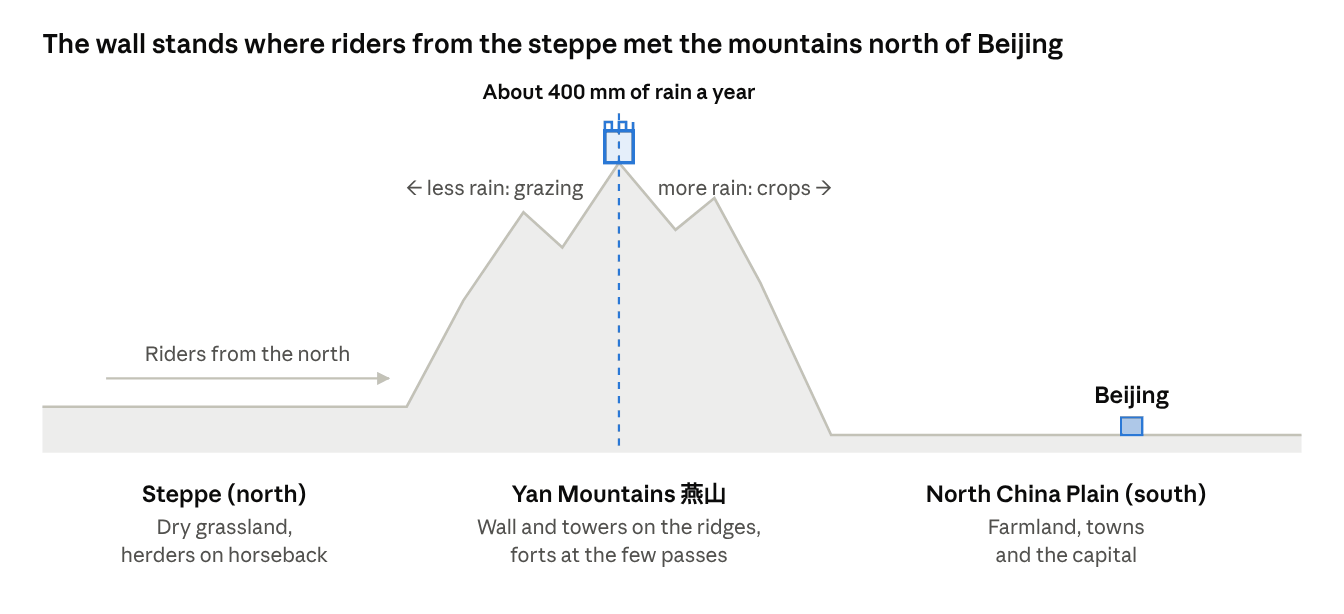
North of the wall lies dry grassland, the steppe. The people who lived there herded animals, and their armies fought on horseback; the Mongols, and before them peoples such as the Xiongnu, could ride fast and raid deep into farming country. South of the wall lies the North China Plain: flat farmland, towns and, from the Ming dynasty on, the capital. Once riders were through the mountains, little on the plain could slow them.
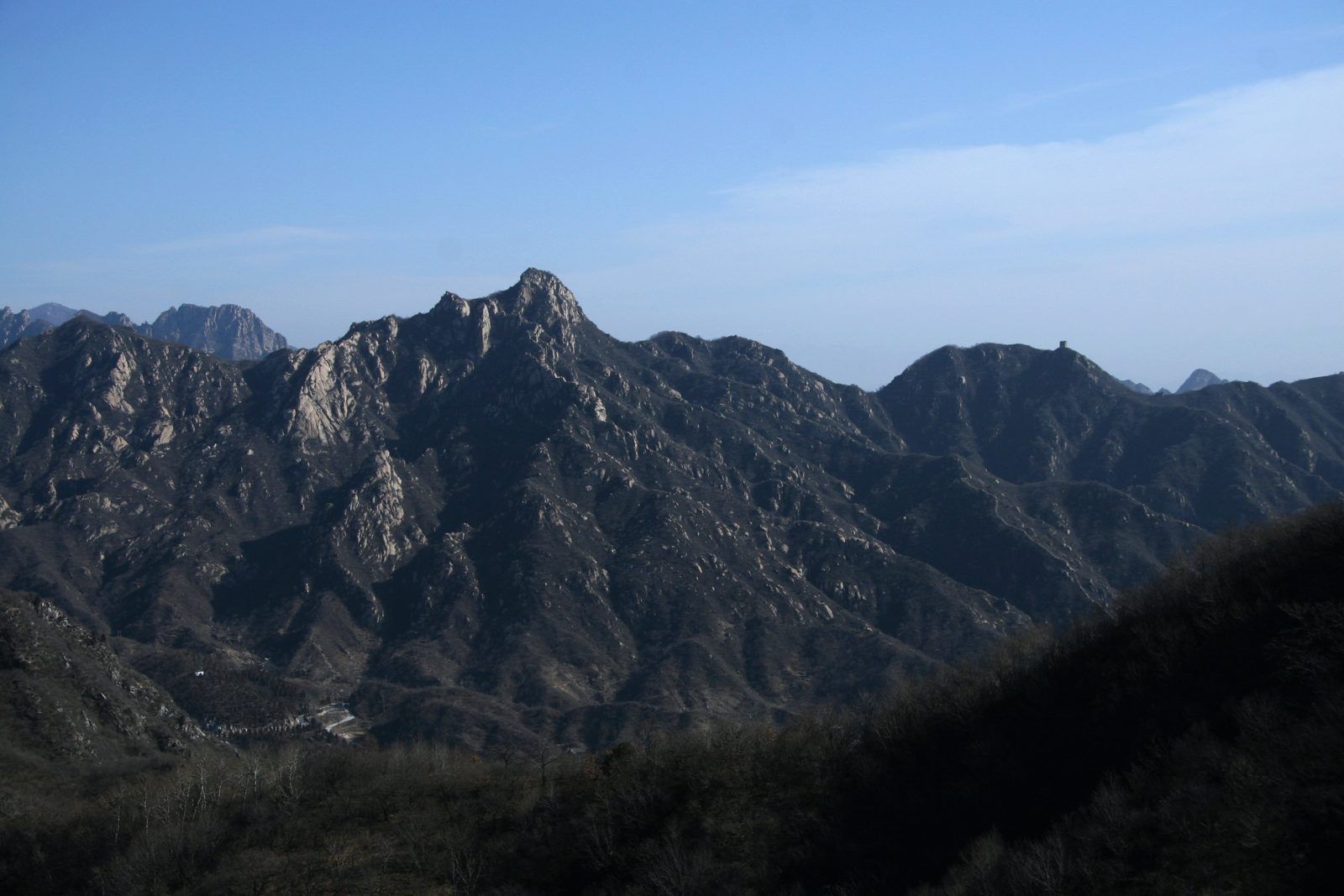
In between are the Yan Mountains (燕山), which riders could cross easily only at a few gaps, called passes. Juyong Pass (居庸关), near Badaling, sits where two ranges meet and was called the natural gateway to the capital's north-west. The Ming built the wall along the ridges and put their strongest towers and fortresses at the passes.
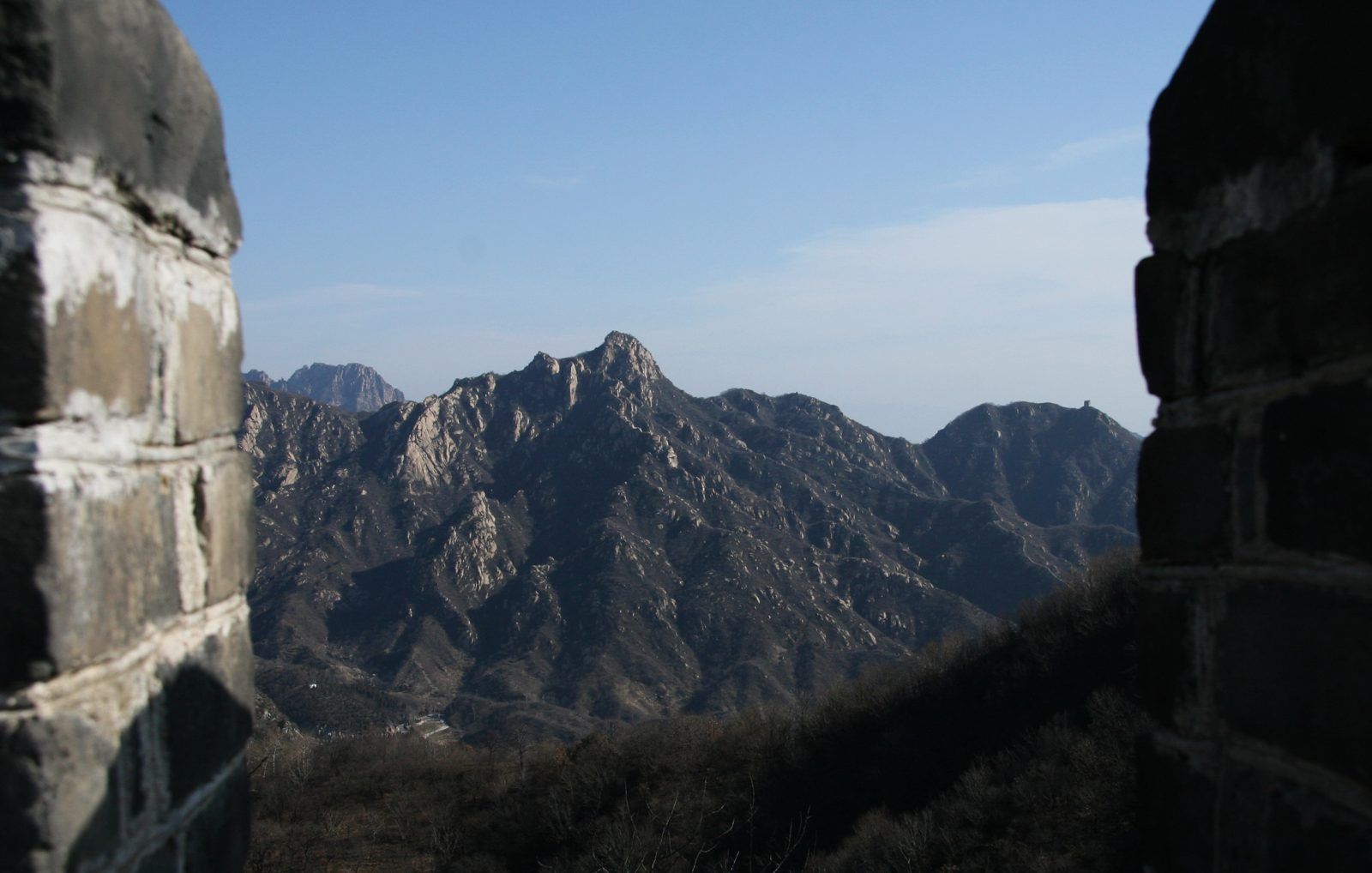
The Yan Mountains from the wall at Mutianyu · Photo: licensed stock image
Rain draws a line too. Historians point out that China's northern walls mostly follow the line where yearly rainfall drops to about 400 mm. South of it there is enough rain to grow crops; north of it the land suits grazing. The wall was not meant to be a perfect seal: it slowed horses down, gave early warning, and let defenders move soldiers along its top.
North to south across the wall, simplified and not to scale · Diagram: PreeChina
Mutianyu
Six stations at Mutianyu
Station M1 The ridge line: how steep is it?
Look. From the car park or the cable car, follow the wall with your eyes. It climbs along the very top of the ridges and drops into the dips between them.
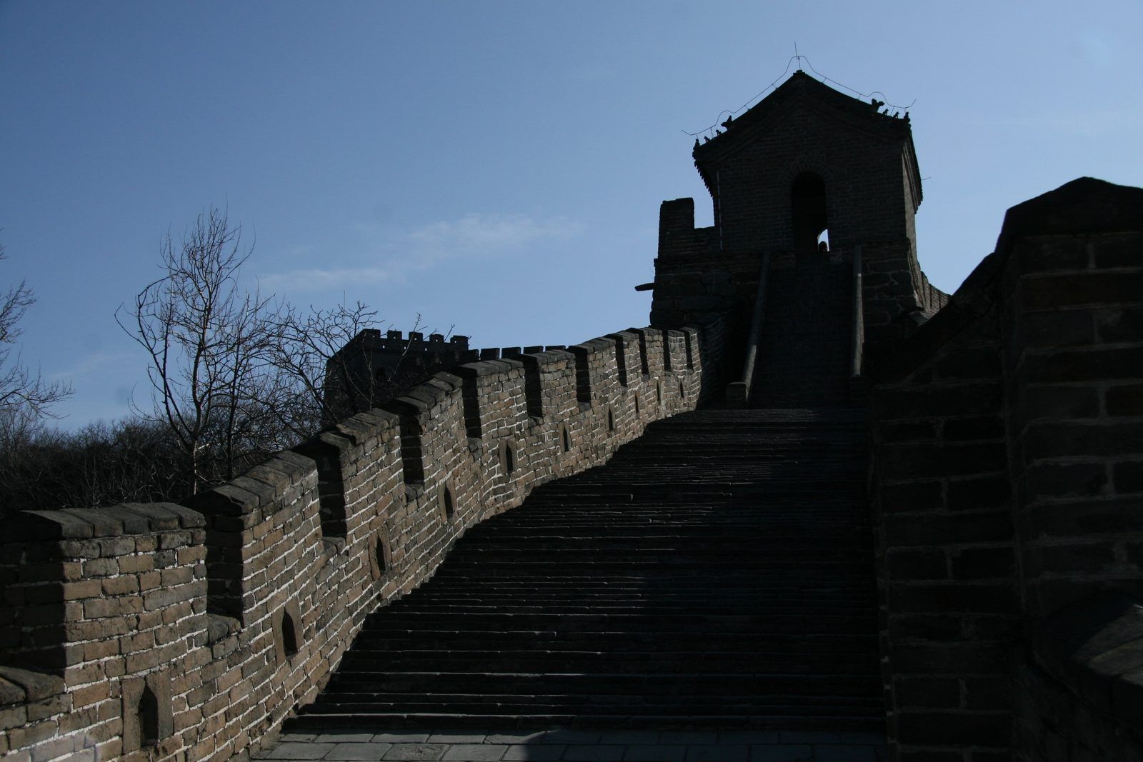
Steep steps up to a watchtower at Mutianyu · Photo: licensed stock image
Know. Ming builders put the wall on the crests of the mountains, so an attacker had to climb a steep slope before even reaching it. Every brick and block was carried up slopes like these.
The Think, Do and Then & Now tasks for this station are in the full guide.
Station M2 Zhengguantai: the three towers正关台
Look. Find three watchtowers standing side by side, each with two floors, linked so that soldiers could walk from one into the next.
Know. This is Zhengguantai, also called Mutianyu Pass or the Three Towers (三座楼), built in 1404, early in the Ming dynasty. A pass is a gap where a road could cross the mountains, so it needed the strongest defence on the section.
The Think, Do and Then & Now tasks for this station are in the full guide.
Station M3 Both sides of the wall
Look. Stand in the middle of the walkway and look left, then right. Both edges have a wall with gaps in it.
Looking out through a gap in the battlements · Photo: licensed stock image
Know. The gaps are battlements, or crenellations (垛口). At Mutianyu they run along both sides of the wall.
The Think, Do and Then & Now tasks for this station are in the full guide.
Full station, as in the guide
Station M4 Watchtowers and beacons: sending a warning
Look. Go inside a watchtower and find three parts: the solid base, the room, and the flat top. Then count how many other towers you can see.
Watchtowers along the wall at Mutianyu · Photo: licensed stock image
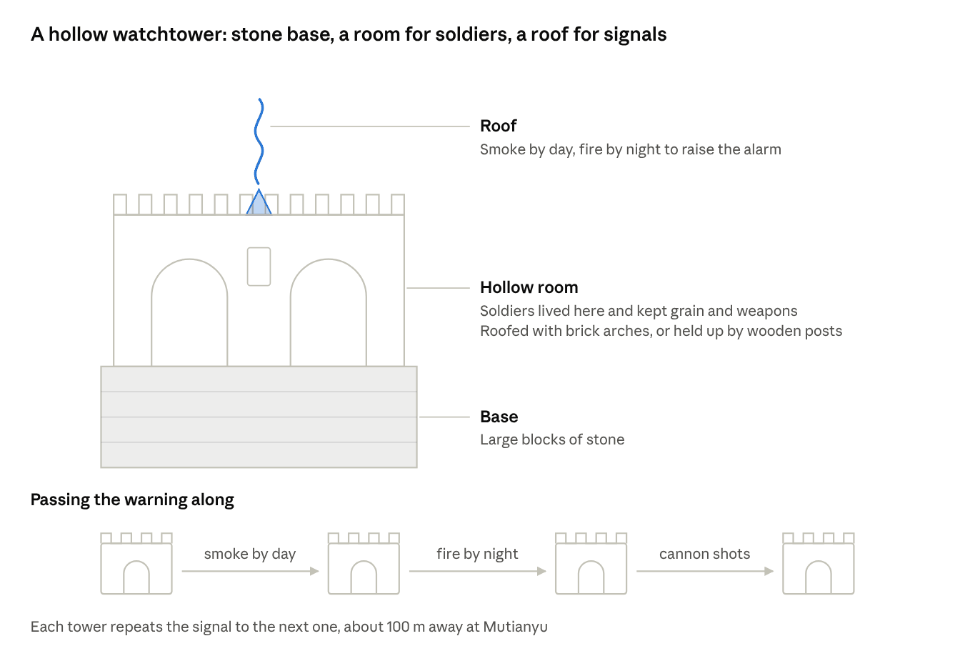
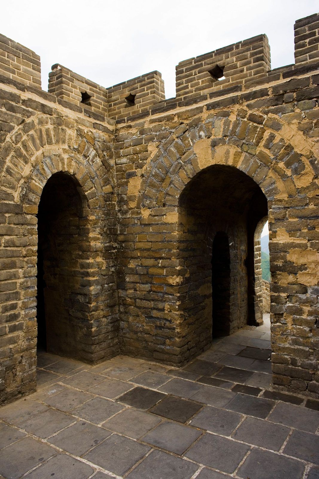
Know. Many towers on the Ming wall near Beijing are hollow towers (空心敌台), a design introduced by General Qi Jiguang. The base is large blocks of stone. The middle is a hollow room, roofed with brick arches or held up by wooden posts, where soldiers lived and kept grain and weapons. The top is a flat roof where they could light smoke or fire to raise the alarm.
A hollow watchtower, and how a warning passed along the wall · Diagram: PreeChinaInside a watchtower: brick arches hold up the roof. Photo taken at Badaling · Photo: licensed stock image
At Mutianyu the towers stand about 100 m apart, so each one can see its neighbours. A warning passed from tower to tower: smoke by day, fire by night, and cannon shots. The number of signals told the next tower roughly how large the enemy force was.
Think. What can a smoke signal tell the next tower, and what can it not tell them? What would go wrong in rain, fog or strong wind? Why add cannon shots as well?
Do.
Explore: Draw a cut-away of this tower showing base, room and top. Mark where soldiers slept, where they kept supplies and where they lit the fire.
Extend: Use the 100 m spacing to work out how many towers a message would pass through to travel 10 km.
Challenge: Design a code that tells the next tower both how many riders are coming and which direction they are coming from, using only smoke, fire and bangs.
Then & Now. On 19 July 1588 the Spanish Armada was sighted off Cornwall, and England lit a chain of beacons along its coast to spread the warning. Today a warning crosses the same distance by radio or phone in seconds.
Station M5 Stone and brick
Look. Find a place where the lower courses of the wall show. Compare the big stone blocks at the bottom with the bricks above.
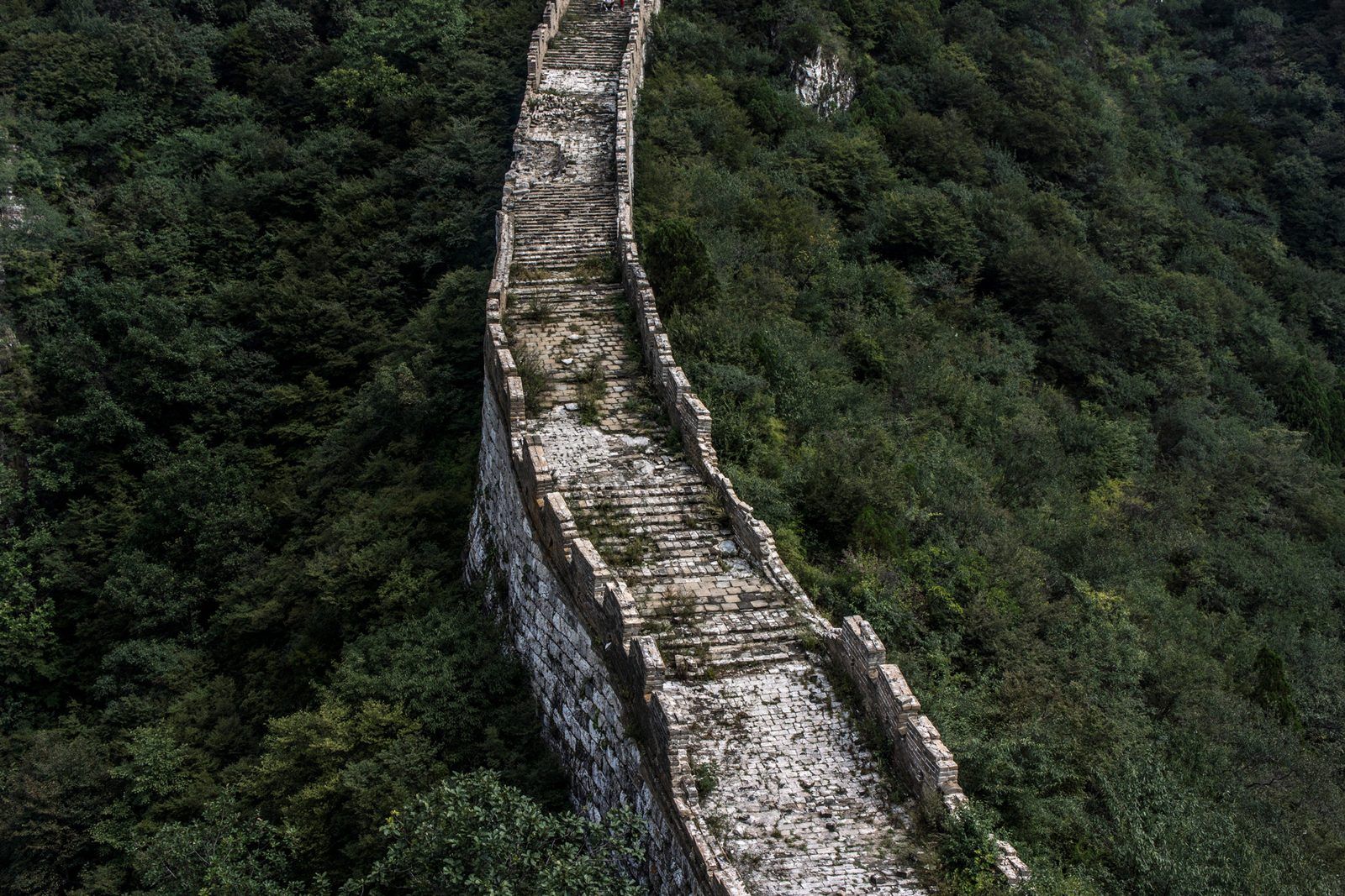
Know. The restored wall at Mutianyu uses slabs of granite, an igneous rock that forms when molten rock cools slowly underground, which gives it crystals you can see. Moving material up here is still hard: when workers repaired the unrestored Jiankou section in recent years, mules carried water and lime mortar up the mountainside, and the workers reused bricks that had fallen from the old wall.
The Think, Do and Then & Now tasks for this station are in the full guide.
Station M6 Looking west: Ox Horn Edge牛犄角边
Look. At the western end of the open section, look north-west. The wall climbs a cliff, turns at the top and comes back down, in a shape people compare to an ox horn.
Know. The Ox Horn Edge reaches a summit of 1,039 m. Further west lies Jiankou (箭扣), a section that has not been restored, which raises the question students debate: should every old wall be rebuilt, or should some be left as ruins?
The Think, Do and Then & Now tasks for this station are in the full guide.
Badaling
Four stations at Badaling
Badaling is about 80 km north-west of central Beijing, in Yanqing District.
Station B1 The pass fortress关城
Look. Before climbing, find the walled square with a gate at each end. The east end is narrow and the west end is wide.
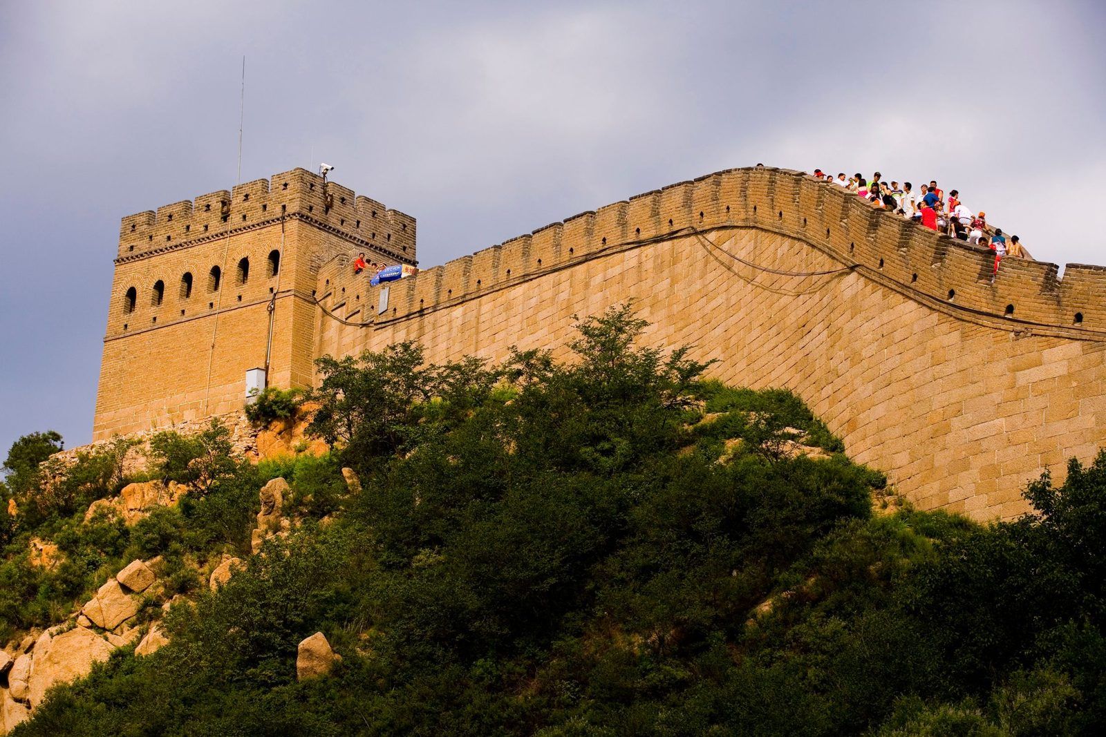
The restored wall at Badaling · Photo: licensed stock image
Know. The pass fortress was built in 1505, and its two gates are 63.9 m apart. The board over the east gate reads 居庸外镇 (Jūyōng Wàizhèn, "the outer guard of Juyong Pass"), carved in 1539. The board over the west gate reads 北门锁钥 (Běimén Suǒyào, "the lock and key of the northern gate"), carved in 1582.
The Think, Do and Then & Now tasks for this station are in the full guide.
Station B2 North Tower 8北八楼
Look. Climb the northern side to North Tower 8, also called the Sunrise Tower (观日台).
A watchtower at Badaling · Photo: licensed stock image
Know. At 888 m it is the highest tower at Badaling. It has two floors, and on the lower floor the wall facing the enemy has six arrow windows, which students compare with the battlements on both sides at Mutianyu.
The Think, Do and Then & Now tasks for this station are in the full guide.
Station B3 A wall for visitors
Look. Look at the people around you. How many languages can you hear?
Know. In 1957 Badaling became the first restored section of the Ming wall opened to tourists. More than 500 national leaders and other prominent visitors have come here, including US Presidents Nixon and Reagan, British Prime Minister Thatcher and Queen Elizabeth II.
The Think, Do and Then & Now tasks for this station are in the full guide.
Station B4 The railway through the wall
Look. Arriving by train, notice how the line climbs through the mountains near the wall.
Know. The Beijing–Zhangjiakou Railway (京张铁路) was the first railway built in China by Chinese engineers without foreign control. Its engineer, Zhan Tianyou (詹天佑), designed a zigzag section shaped like the character 人 to climb the slope near Qinglongqiao Station (青龙桥站), built in 1905 at the foot of the Badaling wall. Today a high-speed line runs from Beijing North Station to Badaling Great Wall Station.
The Think, Do and Then & Now tasks for this station are in the full guide.
Big Talk
Has the West built anything like this?
People far from China came up with many of the same ideas: walls on high ground, towers at regular spacing, battlements, and fires that pass a warning along a line.
Great Wall (Ming, near Beijing)
Hadrian's Wall, England
Castles of medieval Europe
England's beacon chain
Oliver Hill Battery, Rottnest Island
When
Mostly 1368–1644
Begun AD 122; took at least six years
The Middle Ages
Lit after the Spanish Armada was sighted on 19 July 1588
Built 1937; closed in the 1960s
Defending against
Horse-riding raiders from the steppe
Raids from the north
Attackers on foot and on horseback
A Spanish invasion fleet
Enemy ships attacking Fremantle Port
How it worked
Wall on the ridges, towers about every 100 m, fortresses at the passes
A stone wall about 73 miles (about 117 km) long, coast to coast, with a guarded gate every Roman mile and two lookout turrets in between
High stone walls and towers, with battlements and narrow arrow slits
Fires on high points along the coast, each lit when the one before was seen
Two 9.2-inch guns on a hilltop, able to fire about 28 km out to sea, with tunnels underneath
Students then argue whether these ideas were copied or invented separately, who decides who counts as the outsider (Hadrian's biographer said the wall was meant "to separate the Romans from the barbarians"), and what a wall is worth if it can be crossed: in 1644 a Ming general opened a gate in the wall and let Manchu armies through. The guide ends with two walls that are not about armies, WA's No. 1 Rabbit-Proof Fence and the Berlin Wall.
For Teachers
Curriculum links
Year levels follow the Western Australian Curriculum from the School Curriculum and Standards Authority (SCSA). Teachers using another curriculum can map the same stations to their own course; check the content descriptions against the current documents.
Station
Year · Learning area
Content it supports
Before you go, Big picture
Year 7 HASS · History
Depth study of an ancient society (China option)
M6
Year 7 HASS · History
Investigating the ancient past: why conserving the remains of the past matters
Before you go, M2, Big Talk
Year 8 HASS · History
Depth study options include the Mongol expansion (c.1206–c.1368), where taught
M4, Big Talk
Year 8 HASS · History
Depth study options include Medieval Europe, where taught
Why here?
Year 7 HASS · Geography
Water in the world: how rainfall varies from place to place and shapes land use
M1, M4, B2
Year 8 HASS · Geography
Landforms and landscapes: mountains, and how people use them
M5
Year 8 Science · Earth and space sciences
Igneous, sedimentary and metamorphic rocks and how they form
B4
Year 8 Science / Design and Technologies
Forces and slopes; how engineers solve a design problem
Glossary
Names to match on the signs
Chinese
Pinyin
English
长城
Chángchéng
the Great Wall ("long wall")
慕田峪
Mùtiányù
Mutianyu
八达岭
Bādálǐng
Badaling
正关台
Zhèngguāntái
Zhengguantai, Mutianyu Pass
敌楼
dílóu
watchtower
垛口
duǒkǒu
battlement
牛犄角边
Niújījiǎo Biān
Ox Horn Edge
箭扣
Jiànkòu
Jiankou (unrestored section)
关城
guānchéng
pass fortress
居庸外镇
Jūyōng Wàizhèn
"Outer guard of Juyong Pass" (east gate, Badaling)
北门锁钥
Běimén Suǒyào
"Lock and key of the northern gate" (west gate, Badaling)
北八楼
Běi Bā Lóu
North Tower 8
戚继光
Qī Jìguāng
Qi Jiguang, Ming general
詹天佑
Zhān Tiānyòu
Zhan Tianyou, railway engineer
Full Guide
For teachers and trip leaders
Get the full Great Wall field guide
The full guide is a printable PDF for teachers, school trip leaders and travel companies. It adds what this preview leaves out:
the Think, Do and Then & Now tasks for every station, at three levels (Explore, Extend, Challenge)
the Test it yourself sheet and the Back to the big question worksheet
teacher pages: answers, notes for the day, and the points still being checked
Use the request form and tell us your name, your school or company, and the guide you want. PreeChina sends the PDF by email for use with your own classes.