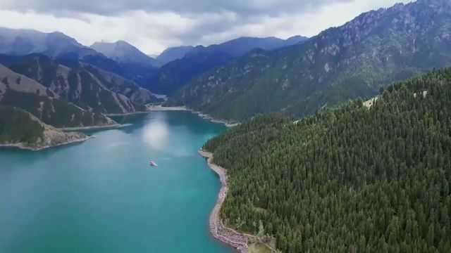
A high grassland basin in the Tianshan of central Xinjiang, where the Kaidu river loops back on itself again and again across almost flat ground. It is also where a Mongol people who walked back from the Volga in the eighteenth century were settled, and it is a breeding ground for swans.
Quick Facts
The Short Version
What it is
A high, flat, wet grassland basin ringed by mountains, with a river meandering extravagantly across it
Where
Hejing county, Bayingolin prefecture, in the Tianshan of central Xinjiang
The well-known view
A ridge-top viewpoint over the river bends, which is where every photograph of this place is taken from
Why the river bends
The basin is nearly level, so the river has almost no fall to work with and spreads sideways instead of cutting down
Who lives here
Mongol herders. This is where the Torghut people were settled after their return from the Volga in the eighteenth century
The birds
A swan breeding ground, which is one of the reasons the basin is protected
The season
Short. The grass is green and the basin accessible for a few months in summer
Time needed
One night nearby. The view is an evening, not a day
Why Go
One View, and Why It Is Worth Planning For
1. Be honest about what this place is
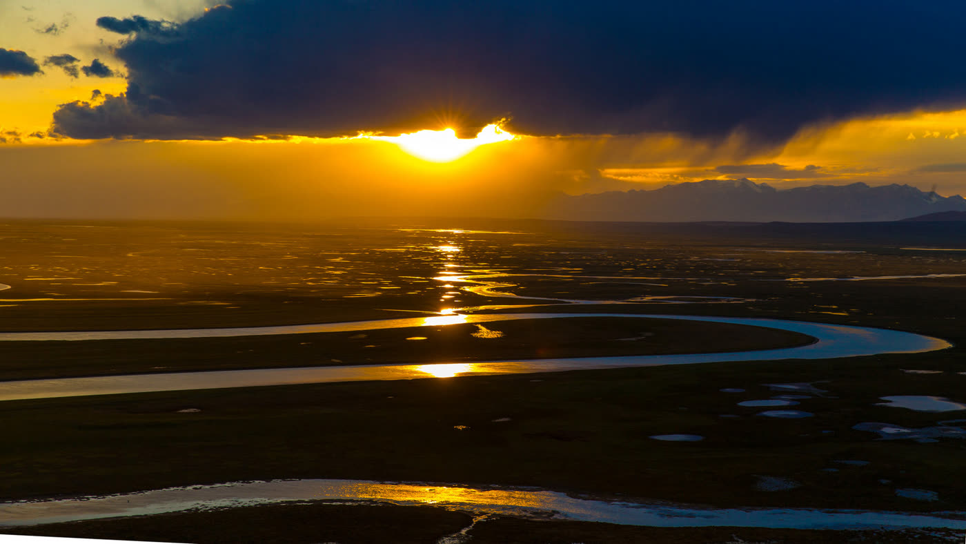
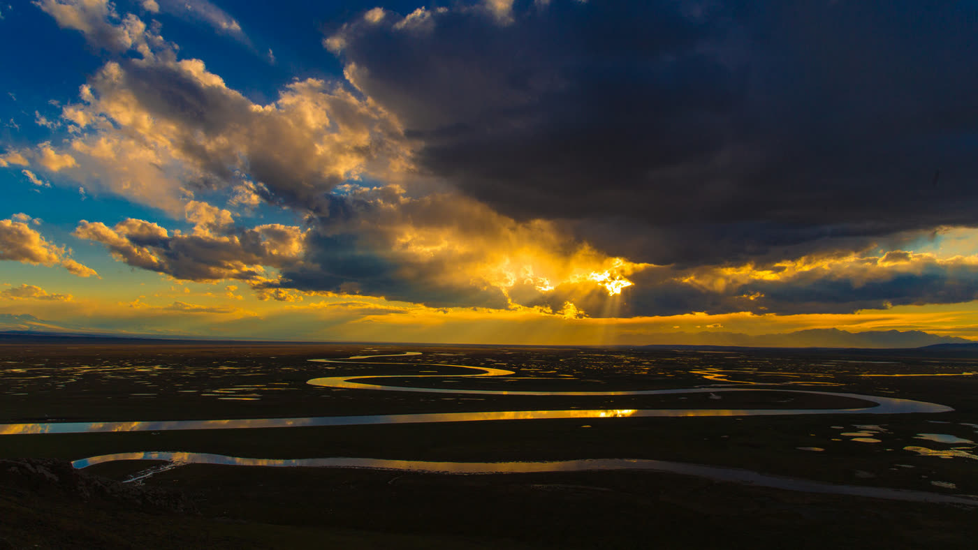
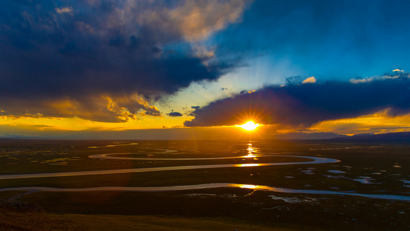
The photo library for this entry contains eighteen images. All eighteen were taken from one viewpoint during one sunset. That is not a failure of the library; it is an accurate description of how this place is visited and photographed. There is a ridge above the basin, there is a bend in the river below it, and there is a particular hour when the low sun turns the water into a chain of silver loops.
Knowing that is practically useful. Bayanbulak is a very large area of grassland and much of it looks like grassland, which is to say flat and green and much like grassland elsewhere. The trip works if it is built around being on that ridge in the last hour of light, and it disappoints if it is built around driving across a steppe expecting the landscape to perform continuously. Plan for the hour.
2. The river is the subject
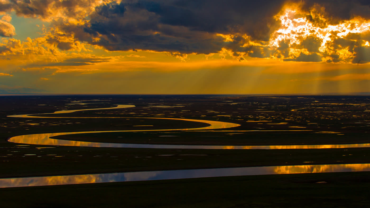
What the viewpoint shows is a river behaving in a way rivers do not usually get to. The Kaidu crosses a basin that is almost perfectly level, so it has hardly any gradient to work with. A river with no fall cannot cut downward, so it moves sideways instead, and over time every slight curve deepens into a loop until the loops nearly touch and the river is travelling several times the straight-line distance to get anywhere.
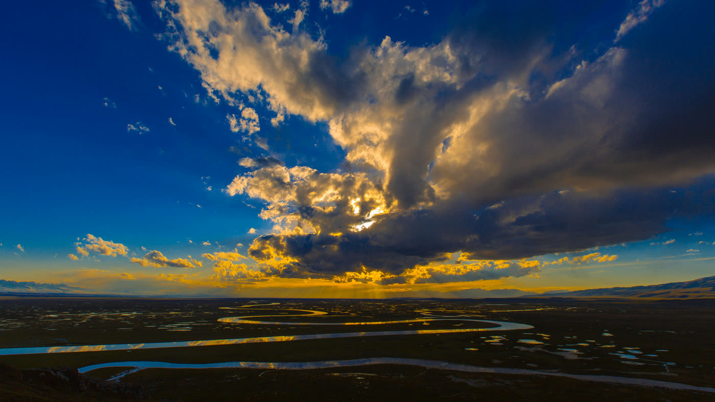
The result is in the pictures: bend after bend folded back on itself, with the cut-off ones left lying about the plain as isolated pools. One of the images here shows dozens of them scattered across the grass. The basin is wet ground rather than dry steppe, which is also why the birds are here.
3. The people who walked back
The herders in this basin are Mongols, and the way they came to be here is one of the more extraordinary migrations on record. In the seventeenth century a Mongol group moved west and settled on the lower Volga, within the Russian empire. In the eighteenth, finding their position there increasingly untenable, a large part of them set out to return east across the steppe to the Qing empire, under attack for much of the way, and arrived reduced by a catastrophic margin.
They were resettled in the Tianshan, and this grassland is part of what they were given. That history is not visible from the viewpoint and none of the pictures on this page show the people or their herds, which is a gap in the media rather than in the place. It is worth knowing anyway, because it changes a pretty grassland into somewhere that a nation walked several thousand kilometres to reach.
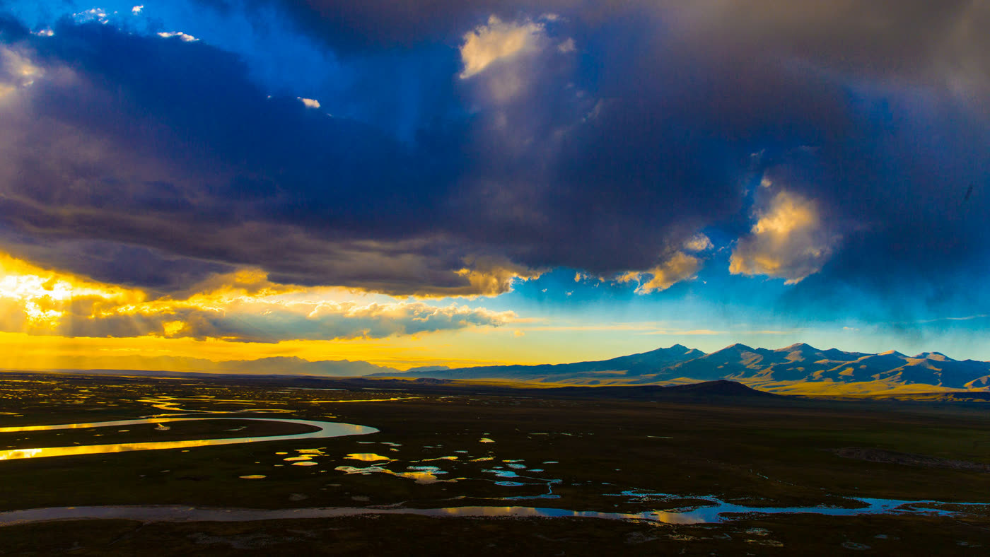
The wider basin. The scattered pools are old river bends that got cut off, which is what a river does when it has nowhere to fall to.The same place with the sun still up. Almost nobody photographs it like this, which is why it is included here.The specific minute the viewpoint exists for. It lasts about as long as it looks like it would.The bends at their clearest. Count how far the water travels to cross the frame.When the sun lines up with the river, the loops light one after another all the way to the horizon.
The catch. The media on this page is one hour from one spot, and so is many of what exists about this place, which should tell visitors what a visit is. The season is short and the basin sits high enough to be cold outside high summer. Getting here is a long drive on a mountain highway that closes with snow. Accommodation nearby is basic. And the photographs depend entirely on the evening being clear, which is not guaranteed.
Orientation
The Ridge, and Everything Else
Practically, this is two things. One is the viewpoint: a ridge above the bend in the river, reached by road and then by shuttle and steps, where everyone goes in the late afternoon and which is the subject of every picture on this page. The other is the grassland itself, a very large area of high pasture with herding settlements, a swan sanctuary and a road across it.
Many visitors do the viewpoint and little else, and given the way the place is set up that is a defensible plan. The decision worth making in advance is where to sleep, because the point of coming is to be on the ridge at sunset, and that rules out doing it as a day trip from anywhere substantial.
Practical
Things Worth Knowing
Build the day around the last hour of light
Everything else here is optional. Arrive with time to get up to the ridge and wait.
Stay nearby rather than driving out the same evening
The viewpoint releases its crowd into a long mountain drive in the dark, which is not the way to finish.
Take more warm clothing than the date suggests
The basin is high and the temperature falls off a cliff as soon as the sun does.
Check the highway before committing
The mountain road in is seasonal and closes with snow, which shortens the window further.
Timing
When to Go
Season
The case for
The catch
June to August
The grass is green, the basin is accessible, the swans are present and the evenings are long
This is the whole season, so it is also when everyone else comes
September
The grass turns and the light gets better as the air dries, with thinner crowds
Nights are already cold and the weather turns quickly
May
Early green, very quiet, and snow still on the surrounding ranges
Cold, unreliable, and the road in may not be open yet
October to April
The basin under snow, which is what it looks like for much of the year
Severe cold, roads closed and effectively not a visitor season
Context
Why Xinjiang Has Grassland at All
Much of Xinjiang is desert, because the mountain ranges that surround it wring the moisture out of anything that reaches them and the basins in between get almost no rain. The exception is the mountains themselves. At height there is enough precipitation, mostly as snow, to support grass, and the high basins and valleys of the Tianshan and the Altay carry pasture that the lowlands cannot.
That is why the pastoral peoples of this region live where they do, moving stock up to the high grass in summer and down before the snow. Bayanbulak is one of the larger of those high pastures, and its flatness and wetness make it unusual even among them: a basin that collects water rather than shedding it, which is what allows the river to wander and the marshes and the birds to exist.
The human history follows the grass. A basin large enough to support herds in quantity is worth settling a population in, which is what the Qing did with the Mongols who came back from the Volga. This site covers the high pasture west of here at Nalati and the lake country of the Altay at Kanas Lake.
Urumqi is the regional capital and the place almost every trip to Xinjiang starts, with the flights and the long-distance rail. Bayanbulak is a long way from it, reached either around through the basin or over the mountains on the highway that crosses the Tianshan.
For many travellers this basin is one stop on a circuit rather than a destination on its own. The mountain highway that runs past it is itself one of the reasons to come, and pairing the viewpoint with the grasslands of the Ili valley to the west makes a coherent few days of high pasture.
Experiences
What Visitors Can Actually Do Here
On site · one evening
The ridge at sunset
Up to the viewpoint in the late afternoon and down after the light has gone, with a bed nearby rather than a drive out.
Entry plus the shuttle.
On site · one day
The basin and the birds
The grassland and the protected area during the day and the viewpoint in the evening, for anyone who wants more than the photograph.
Entry, shuttle and local transport.
Guided · 7 days
The Tianshan highway
This basin with the Ili grasslands and the mountain road that links them, timed to the short season.
Come for one hour and plan the rest of the trip around it. Every photograph of this place, including all six on this page, is the same river seen from the same ridge as the sun goes down, and that is an accurate picture of what a visit is. The reason it works is a basin so flat the river cannot cut downward and folds back on itself instead until the low sun lights the loops one after another. Sleep nearby, be on the ridge early, and read something about the Mongols who walked here from the Volga before visitors go.
Travelling to China with 10 or more people? Talk to PreeChina first. A transparent service fee of USD 100 per person for trips of up to 10 days (USD 150 for 11 to 20 days), and no markup on travel components. See how the fee works.
This basin rewards one hour of one day and the rest of the trip has to be built around getting visitors there for it. Share the travel dates and our local team will handle the mountain highway, put visitors in a bed within reach of the ridge, and pair it with the grasslands west of here so the drive earns its length.