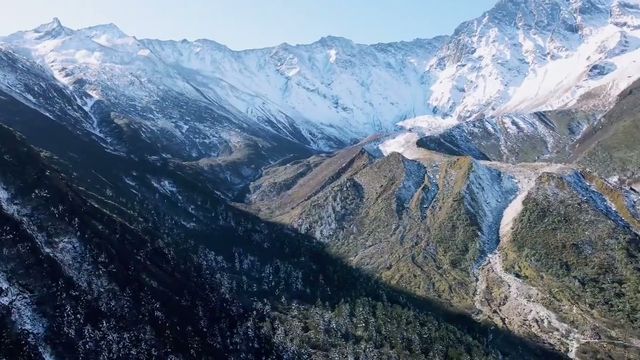
A high protected area in the far southwest of Sichuan built around three snow peaks that carry the names of three bodhisattvas. It is walked rather than looked at, the altitude is the difficulty, and the country on the way in is as good as the protected area itself.
Quick Facts
The Short Version
What it is
A protected area of glacial valleys, alpine tarns and three snow peaks, entered on foot from a shuttle road
Where
Daocheng county, Garze prefecture, the far southwest corner of Sichuan
The three peaks
Each is named for a bodhisattva, and the arrangement is read as a mandala rather than as a range
What people do
Walk. A valley circuit at moderate height, and a harder climb to the tarns at the top
The difficulty
Altitude. The gate is high and the top of the walk is very much higher, and the last section is the one that defeats people
Getting there
An airport at very high altitude, or a long drive from Chengdu. Both have consequences for how visitors feel on day one
Also worth the time
The plateau on the approach: poplar shelterbelts, braided rivers, grazing land and enormous sky
Time needed
Three days minimum, including one for acclimatisation
Why Go
A Mandala Visitors Have to Climb
1. The mountains are an arrangement, not a range
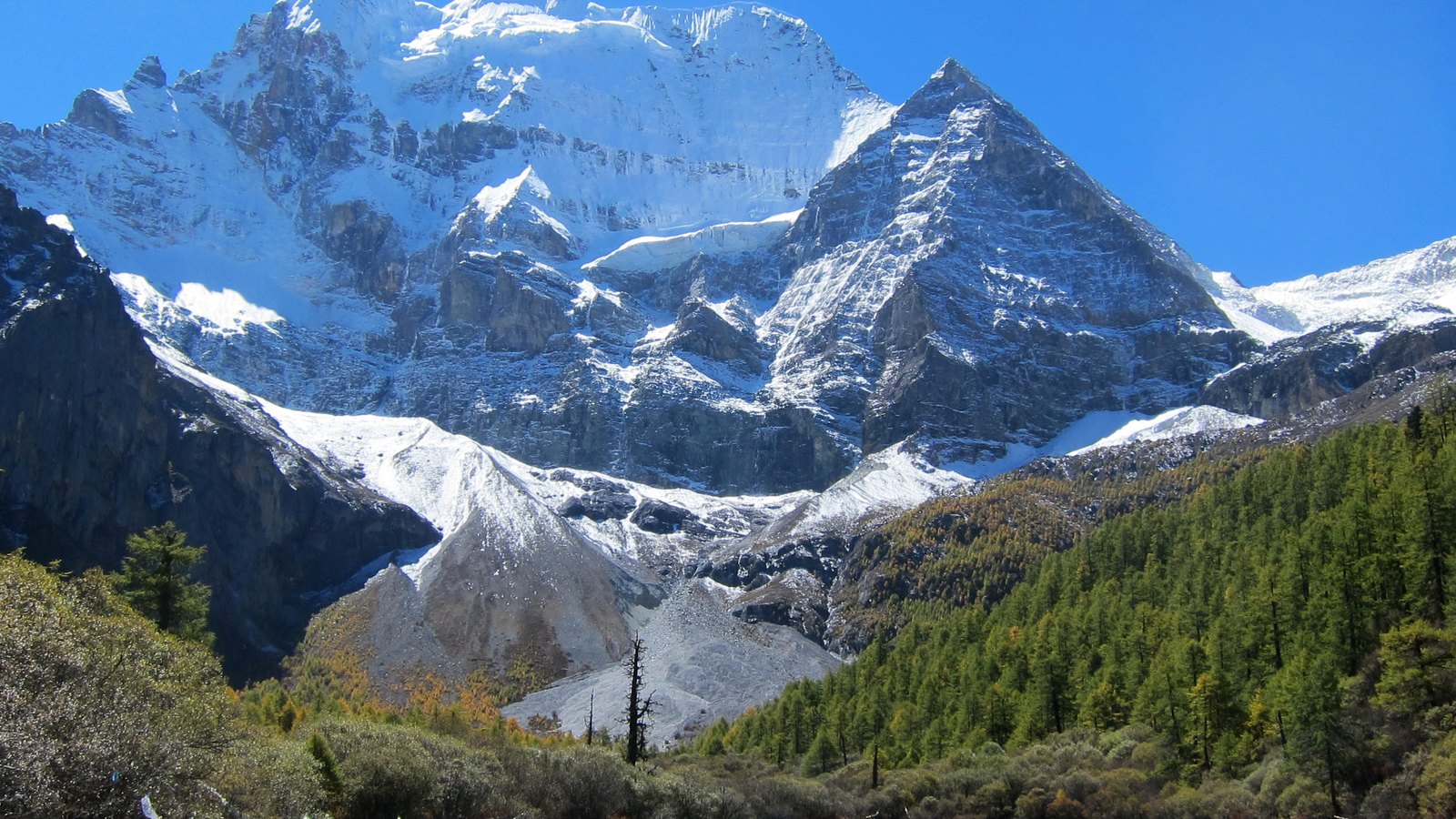
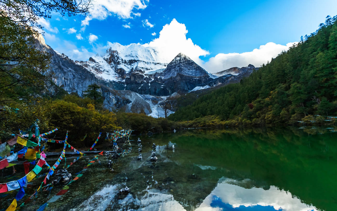
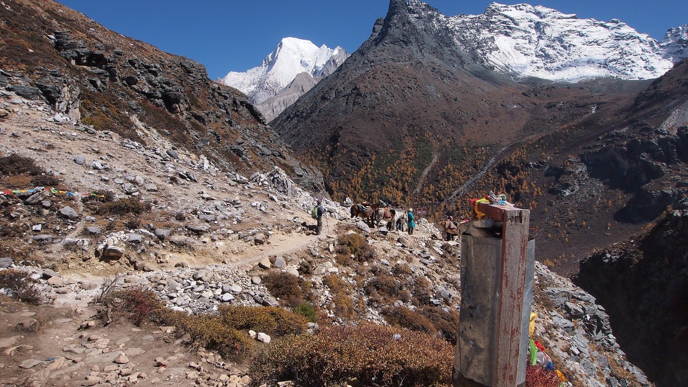
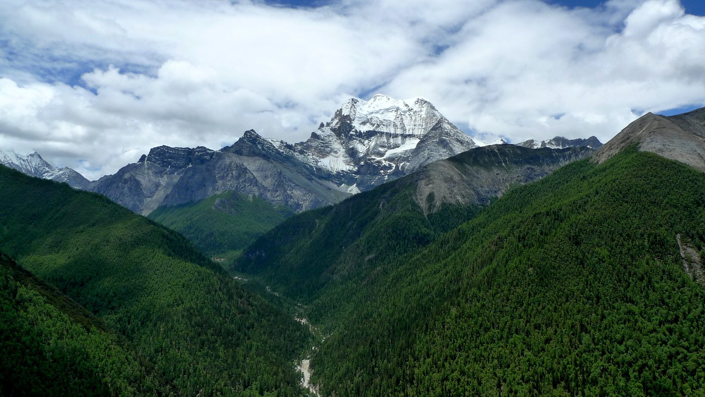
Three snow peaks stand around a centre here, and each carries the name of a bodhisattva. That is not a poetic gloss applied afterwards; it is how the place is organised and how people move through it. Walking between them is a circuit with religious meaning, prayer flags are strung at the lakes, and small stone cairns stand in the shallows of the water. One of the pictures below shows both.
Reading the site that way changes what the walk is. A Western hiker arrives with a summit-and-viewpoint model: get high, look out, come down. What is happening around visitors here is closer to a procession, and the peaks are not there to be climbed. This page does not say which peak carries which name, because that cannot be established from the photographs and the sources disagree in ways that matter to the people who come here to walk it.
The mountains reached Western attention in the late 1920s, when a foreign botanist working in southwest China published photographs and an account of them. The protected area now markets itself as the original of a well-known fictional valley from a novel of the following decade, which is a claim made locally and by several other places in the region as well.
2. The altitude is the visit
The gate is already high and the upper tarns are far higher, and almost everything that goes wrong here goes wrong because of that gap. A visitor who flies in lands at an airport high enough to cause problems on the opening afternoon, walks the next morning, and finds that a path that would be an easy hour at home takes three and hurts. Horses can be hired for part of it, oxygen is sold at the trailhead, and both are doing real business.
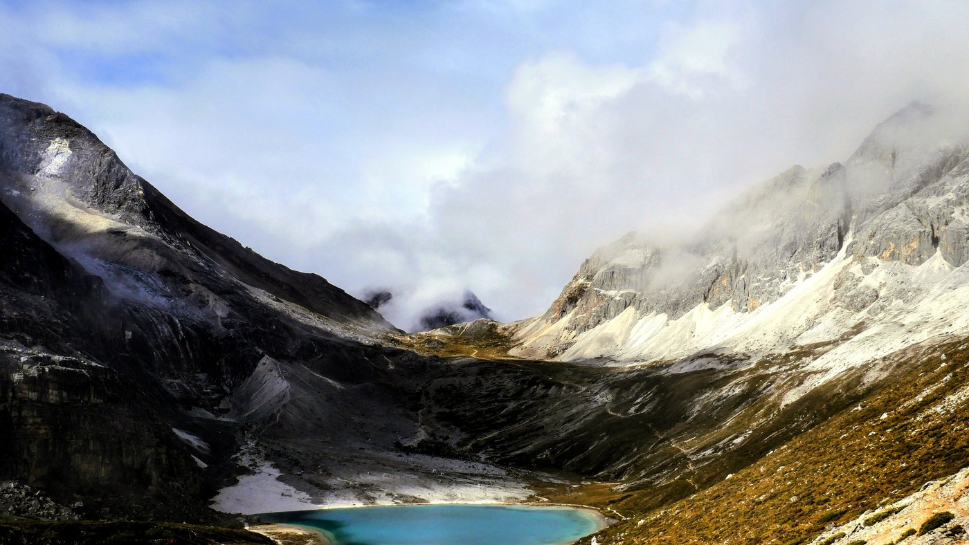
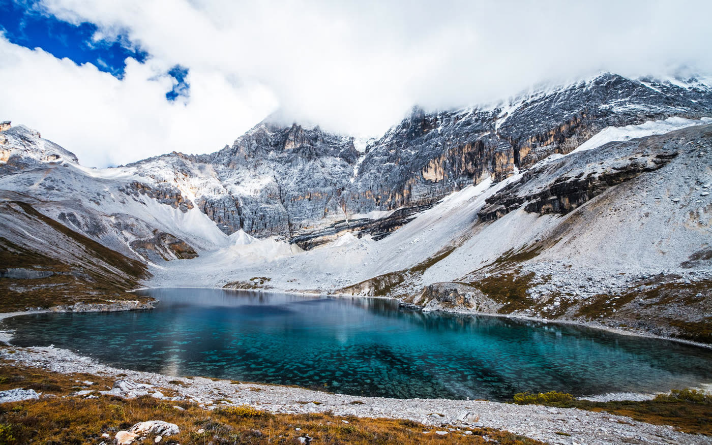
What the effort buys is specific and worth knowing in advance. The upper basins hold small lakes of two quite different kinds, and two of the pictures below show the pair. One is a flat milky turquoise, opaque, ringed with a pale shelf of fine sediment: that colour is rock ground to flour by ice and held in suspension. The other is clear enough that the mottled pattern of the stones on the bottom shows through the blue. Same mountain, same week, different water.
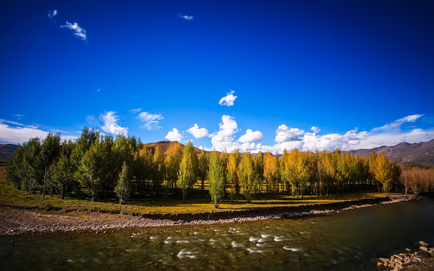
The approach is the other half of the trip and many itineraries waste it. The plateau on the way in is open grazing country with braided rivers over pale gravel, planted rows of poplars turning gold in October, grass hills and a sky that is the reason people describe this part of Sichuan the way they do. One of the pictures below is that country rather than the protected area, and it is there on purpose.
The lower lake, with flags and stone stacks left by people walking the circuit. This is the part of the protected area many visitors reach.The other kind of high lake, an hour or so from the at the start: clear enough to read the bottom through it. The difference is how much ground-up rock the inflow is carrying.The plateau on the way in, in October. The poplars are planted in rows as shelter, which is worth noticing: this is farmed and grazed country, not wilderness.
The catch. Altitude is the real constraint and it is not a formality: people are taken off the upper trail every day in season. The site is far from everything, the airport is expensive and weather-dependent, and the drive from Chengdu is two long days. Inside the protected area the shuttle and the walking are strictly routed and the upper section becomes a line in peak weeks. Autumn is when the valleys turn and the peaks are out, and it is also when beds and flights are hardest to get.
Orientation
Town, Gate, Shuttle, Foot
The pattern is fixed. Sleep in the town outside the protected area or in the village inside it, take the shuttle from the gate up to the trailhead, and walk from there. A lower circuit takes in the monastery, the valley floor and the opening lake, and is manageable for many people. The upper section climbs to the high tarns and is the part that requires the day to be planned around it.
Horses can be hired for a stretch of the upper route and are worth considering rather than dismissing. The cost of pride here is spending the rest of the trip in a room with a headache.
Practical
Things Worth Knowing
Give the altitude a day before visitors use it
Arriving and walking high the next morning is how many visits go wrong.
Sleep inside the protected area if visitors can
It removes the morning commute and puts visitors under that sky at night.
Book autumn far ahead
October is when the valleys turn and when everything is full.
Take the approach seriously
The plateau on the way in is not dead time between the airport and the gate.
Timing
When to Go
Season
The case for
The catch
Late September to late October
The valleys turn rust and gold, the air is clear and the peaks are out many days
The busiest and many expensive weeks of the year, and beds sell out months ahead
May and June
Green, flowering and far quieter, with snow still heavy on the peaks
Cloud increases through June and the upper walk can be wet
July and August
Warm at the valley floor and the whole protected area open
The wet months. Cloud sits on the peaks and the upper paths are muddy
November to April
Empty, cold and very clear on the good days
Snow closes sections, the road can be difficult and services run at a minimum
Context
The Far Corner of Kham
This is the southeastern edge of the Tibetan plateau, in what was historically Kham, and it is Tibetan country in language, religion and building rather than a Sichuan valley that happens to be high. The monasteries, the flags, the stone stacks and the mani walls are not decoration laid over a scenic area; they are what the place was doing before anyone sold a pass.
It came to Western notice in the late 1920s through a foreign botanist who spent years in the southwest collecting plants and photographing what he saw, and who published on these mountains in a widely read magazine. A novel of the following decade invented a hidden Himalayan valley that has been attached to the region ever since, and several places in Yunnan and Sichuan now claim to be its original. The claim sells passes and is not verifiable, and the mountains do not need it.
What changed the place recently was access. An airport at very high altitude and improved roads turned a journey that used to take a week from Chengdu into something a Chinese traveller can do over a long weekend, and the visitor numbers followed. The protected area is managed tightly as a result, with a fixed route, a shuttle and a cap in busy periods. That is the reason the paths in these photographs are worn into braids, and it is also the reason the valley floors are still intact.
A glacier that comes down into forest, on the way back toward Chengdu.
Two days.
Where to Base
Daocheng (稻城)
Daocheng town is the county seat and the practical base, a couple of hours from the protected area gate, with the airport on the plateau above it. There is also accommodation at the village inside the protected area, which is the better choice for anyone doing the upper walk.
Chengdu is the gateway city for the whole region: flights to the plateau airport, or two long days of driving through country that people make the trip for on its own. Flying up and driving out is easier on the body than the reverse.
Experiences
What Visitors Can Actually Do Here
On site · one day
The lower valley
The shuttle, the monastery, the valley floor and the opening lake, at a height many people manage on their second day at altitude.
Arrange the pass plus shuttle.
On site · one long day
The high tarns
The upper climb to the two high lakes, with horses for part of it if wanted.
Arrange the pass, shuttle and horse hire.
Guided · 8 days
Western Sichuan by road
Chengdu to the plateau and back, with the protected area given three days and the country on the way treated as part of the trip.
Give it three days and spend the opening one doing very little. The three peaks are arranged rather than ranged, the walk between them is a circuit with meaning attached, and the two high lakes are worth the climb if the air lets visitors make it. And do not treat the plateau on the way in as travel time: poplars in rows turning gold beside a braided river under that sky is the other half of what visitors came for.
Travelling to China with 10 or more people? Talk to PreeChina first. A transparent service fee of USD 100 per person for trips of up to 10 days (USD 150 for 11 to 20 days), and no markup on travel components. See how the fee works.
The mistake on this trip is almost always the schedule rather than the route. Share the travel dates and our local team will build in the acclimatisation day, get visitors a bed inside the protected area for the high walk, and arrange horses so that the last climb is a choice rather than a problem.