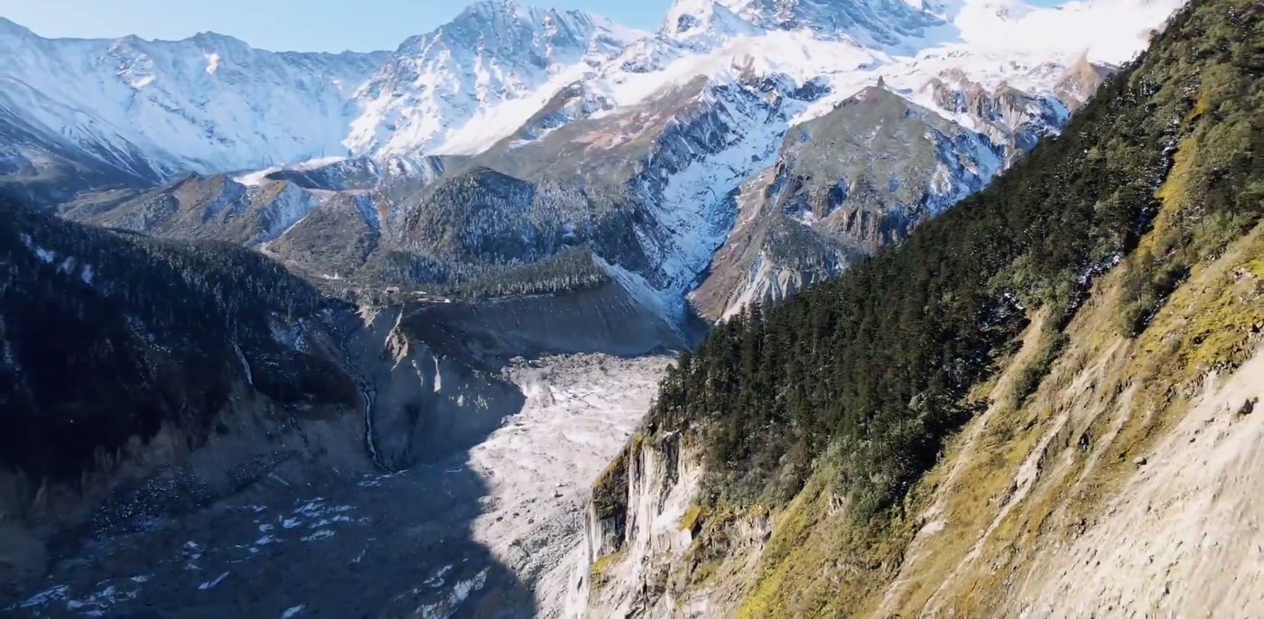
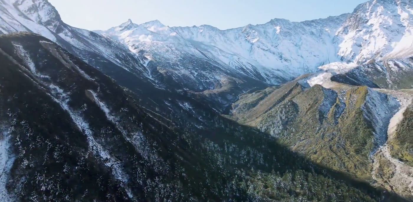
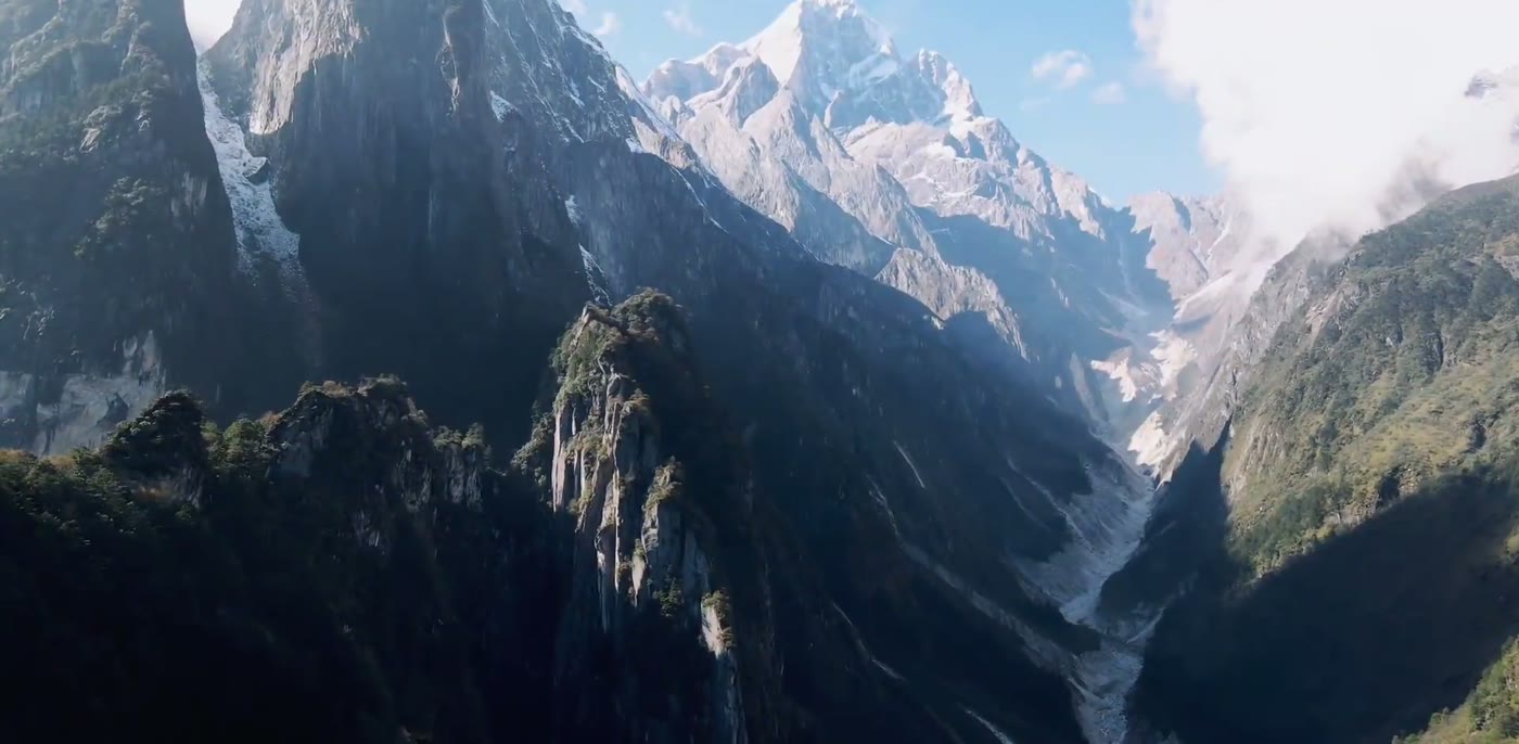
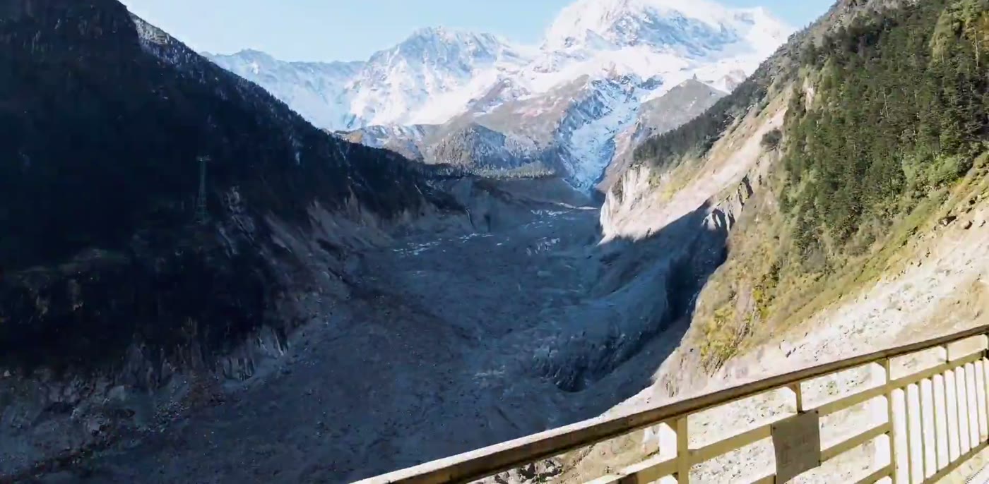
The eastern flank of Gongga Shan, where a glacier comes down far enough that conifer forest grows against the ice. The valley floor is subtropical at the bottom and glaciated at the top.
Quick Facts
The Short Version
What it is
A glaciated valley on the east side of Gongga Shan, with a glacier whose lower end reaches down into forest, plus hot springs in the valley below
Where
Luding county, Garze Tibetan Autonomous Prefecture, western Sichuan. Roughly six hours west of Chengdu by road
The mountain
Gongga Shan, also written Minya Konka, listed at 7,556 metres, the summit of Sichuan. This valley is its eastern approach
The relief
From the valley entrance at around 1,600 metres to the summit above 7,500 metres, within about thirty kilometres horizontally
Why the forest matters
The glacier descends below the treeline, so ice and conifer forest meet, which is unusual at this latitude
Altitude
The upper viewing area sits above 3,000 metres and is reached the same day many people leave Chengdu at around 500 metres
The other draw
Hot springs in the lower valley, which is what much of the domestic traffic comes for
Time needed
Two nights, given the drive at each end
Why Go
Ice Where There Should Be Trees
1. A glacier below the treeline
Many glaciers anyone is likely to have visited sit above the last trees, in rock and snow. This one does not. It comes down the valley far enough that dense conifer forest grows along its flanks and, in places, to within a few metres of the ice, and the pictures on this page that look oddly composed are simply showing that: full conifer forest and a glacier in the same frame, with a strip of bare rock between them rather than a zone. A sign at the viewing platform bills this as the lowest-altitude glacier in the world.
The reason is the amount of snow this side of the range receives and the sheer height it falls from. Ice accumulating that high, moving down a steep valley, arrives lower than it otherwise could before it melts. The practical effect for a visitor is that a single day covers vegetation zones that would take a continent to cross: broadleaf forest at the bottom, conifer in the middle, ice at the top.
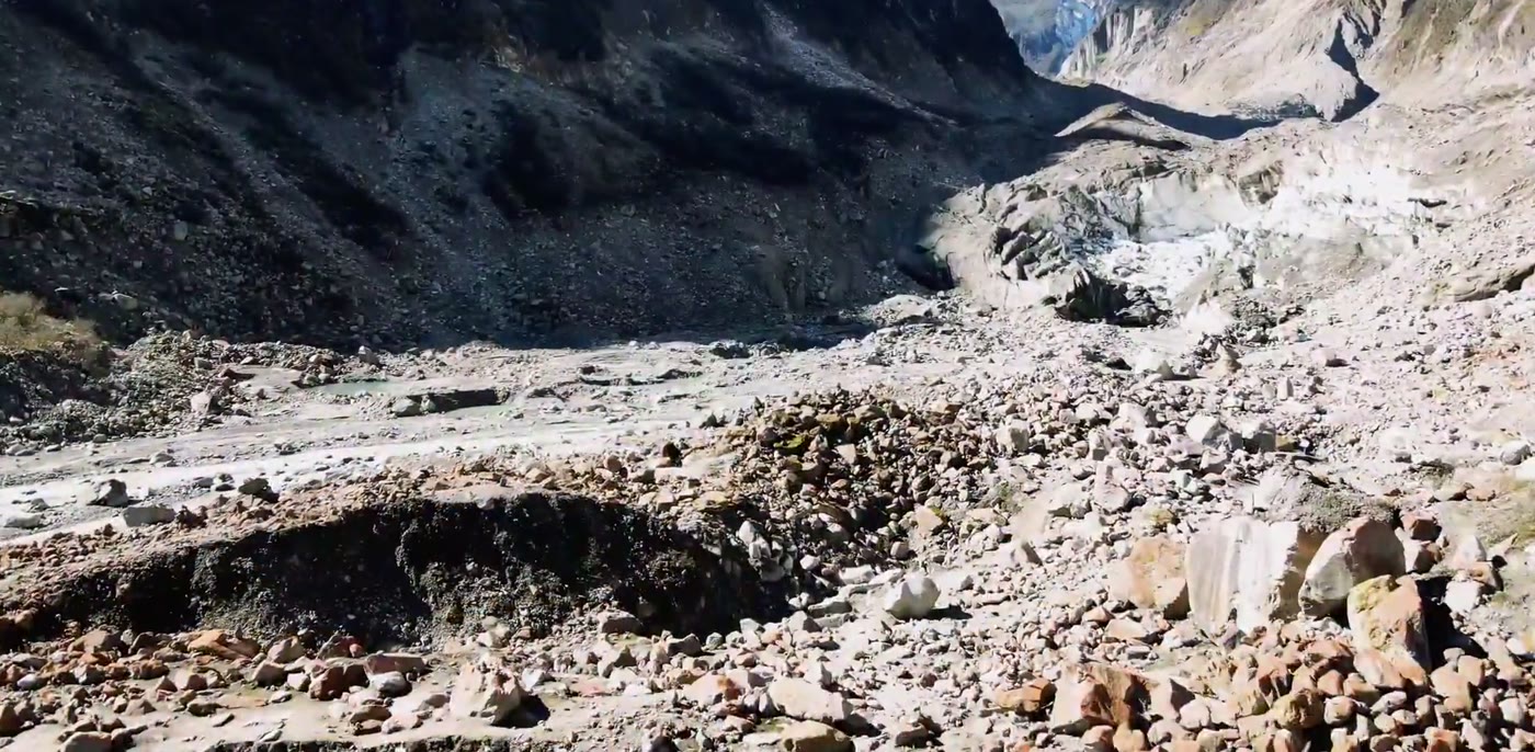
One thing to expect: the glacier does not look like ice. Along its lower reach it is covered in the rubble it carries, so what visitors look down on is a grey and brown river of boulders, with the ice showing through just where the cover has slipped. People who came expecting a white Alpine tongue are sometimes disappointed for the opening ten minutes.
2. The eastern door to Gongga Shan
Gongga Shan is listed at 7,556 metres the summit of Sichuan, and it is not a mountain many visitors ever get near. This valley is the usual way to stand under it without mountaineering. What visitors get is the relief rather than the summit view: from the valley mouth to the top is nearly six vertical kilometres, compressed into about thirty kilometres of map.
How high it is took three tries to settle, and the sequence says something about how recently this corner of the world was measured at all. In 1930 the map in Theodore and Kermit Roosevelt's account of their hunting trip gave the mountain 30,000 feet, a figure that would have placed it above every other peak on earth. Joseph Rock's observations the year before had put it at 25,600 feet. Then in 1932 an American expedition surveyed it from a camp on the far side of the massif, off a base line measured twice with a steel tape, and published 24,891 feet, or 7,587 metres, with a stated probable error of 85 feet. The figure in use today is 7,556 metres. Two men with a mercury barometer and a theodolite came within about thirty metres of it.
That gradient is why the weather here changes so fast, why the forest is so wet, and why the peak is so often hidden. It is also why the valley has been geologically busy: this is a young, rising, seismically active range, and the landslide scars, moraine boulders and rebuilt roads are part of what visitors see.
This is the page in one picture. Full conifer forest and a glacier in the same frame, with just a narrow strip of bare rock between them, which is not how glaciers usually end.The treeline, crossing the slope. Below it forest, above it rock and snow, and the whole sequence fits inside one morning here.The walls of the valley, with trees holding onto rock that steep. The pale floor at the right is the glacier, seen from a long way up.The rubble is riding on top of the ice, not lying beside it, and where it slips off the ice shows through. That is why the glacier here looks grey rather than white.From the viewing platform. The railing and the pylon are the sole built things in any of these pictures, and they are the sole scale here: everything else is much larger than it looks.
The catch. This is a long drive from Chengdu on mountain roads, and it is genuinely remote. Altitude is the real risk: people arrive from Chengdu and go straight to over three thousand metres the same day, and headaches and worse are common. The peak is frequently in cloud, so a two-night stay is what gives visitors a chance at it. The valley is also seismically active and roads here have been closed by earthquakes and landslides before, so build slack into the plan.
Orientation
Chengdu, Then A Long Day West
Chengdu is the gateway and the drive is the main cost of coming: roughly six hours west, through Ya'an and over the mountains to Luding, then up the valley. Many people book the round trip as a package with transport included, because public connections are awkward and the last stretch is a mountain road.
Inside the valley, transfer buses run from the gate up through the forest to the upper station, and a cable car covers the last section to the glacier viewing area. Hot spring hotels sit in the lower and middle valley. The usual shape is arrive and sleep low, go up the next morning, and keep the third day for the drive back.
Practical
Things Worth Knowing
Sleep low the opening night
A particularly useful thing visitors can do here. Arriving from Chengdu and going straight to the top is how people get altitude sickness on what looks like an easy trip.
Give the mountain two mornings
Gongga is in cloud a great deal of the time and clear weather tends to come early. One morning is a coin toss.
Bring layers for both climates
The valley floor is warm and wet and the glacier viewing area is cold and windy, and visitors will be in both on the same day.
Check the road before visitors commit
This is an active seismic zone and mountain roads here close. Ask about current conditions rather than assuming the drive is a given.
Timing
When to Go
Season
The case for
The catch
October to November
The clearest air of the year and the ideal odds on seeing the peak, with autumn colour in the forest below
Cold at the top, and the opening snows can affect the road
April to June
Rhododendron and new growth in the forest, and quieter than autumn
Cloud increases through the spring
July to August
Warm in the valley and the hot springs are pleasant in the evenings
Rainy season: cloud on many days, and the time of year landslides close roads
December to March
Snow throughout, very few visitors, and the springs at their peak
Cold, short days, and road and facility closures are common
Context
A Young Mountain, Still Moving
Western Sichuan is where the Tibetan Plateau breaks down into the Sichuan Basin, and it does so abruptly. The plateau sits around four thousand metres; the basin around five hundred. The distance between them, in places, is under two hundred kilometres. Gongga Shan stands on that edge, and this valley cuts into it.
Everything about the place follows from that. Moist air coming off the basin is forced up the escarpment and drops its water, which is why the forest here is so dense and why the snowfall at altitude is heavy enough to feed a glacier this far down. The same collision that raises the range makes it unstable: the faults along this edge are active, and earthquakes and landslides are a recurring part of the valley's history rather than exceptional events.
The mountain itself is a batholith, a mass of granite that cooled slowly at depth and was then pushed up bodily through everything above it. The Swiss geologist Arnold Heim, who published on its structure in the Bulletin of the Geological Society of China, put that vertical movement at more than four miles and probably more than six, and thought the uplift had carried on into recent geological time and might not have stopped. The relief that makes this valley worth the drive is the same fact as the landslides that keep closing the road.
For travellers, this edge is also a cultural boundary. Luding sits at the point where Chinese-speaking Sichuan gives way to Tibetan Garze, and going further west from here means going up onto the plateau proper. Many people treat this valley as an initial stop on that road rather than a destination on its own.
Chengdu is the practical base. Nothing closer has the flights, the hotels or the agencies, and the road west starts there. Two nights in the city at either end of this trip is the normal arrangement, and it is no hardship.
It is also the right place to acclimatise the expectations. Chengdu sits at about five hundred metres in a basin well-known for its haze; six hours later visitors are above three thousand metres looking at a seven-thousand-metre peak. Very few cities in the world have that gradient on their doorstep, and it is the reason Chengdu is the base for so much of high-altitude China.
Experiences
What Visitors Can Actually Do Here
On site · full day
The glacier viewing area
Transfer bus up through the forest, cable car to the upper station, and time at the viewpoints over the ice.
Entry, bus and cable car are separate charges.
On site · evening
The hot springs
The other half of why people come here, and the sensible way to spend the evening after a day at altitude.
Many valley hotels have their own.
Guided · 4 days
Chengdu to Gongga and back
Transport, a night low and a night high to handle the altitude properly, and a guide who can read the weather for the peak.
Two nights, sleep low on the at the start, and go up early on a clear morning. Look at where the ice stops and the trees start, because on much of the planet there is a belt of bare rock between those two things, and the reason there is none here is the same reason the peak above visitors are nearly six kilometres higher than the road them drove in on.
Travelling to China with 10 or more people? Talk to PreeChina first. A transparent service fee of USD 100 per person for trips of up to 10 days (USD 150 for 11 to 20 days), and no markup on travel components. See how the fee works.
Share the travel dates and our Chengdu team will handle the drive, split the altitude over two nights so visitors actually enjoy the top, and check the road before they fly. We can also run this as the opening leg of a longer route west onto the plateau.