
Ngari is in Tibet, in Southwest China.
Home › Destinations › Tibet › Ngari
Tibet · City Guide
Ngari, Where Four Religions Circle the Same Mountain.
Overview
Why Go
Kailash at 6,656 metres is sacred in Hinduism, Tibetan Buddhism, Jainism and Bon, each with its own account of what it is. It has never been climbed. Pilgrims from all four walk the circuit, Bon practitioners in the opposite direction from the rest.
The outer kora runs about 52 kilometres from Darchen at 4,675 metres over the Drolma La at 5,630, usually in three days. Horses and porters can be hired. Altitude is the whole difficulty; the terrain itself is a path.
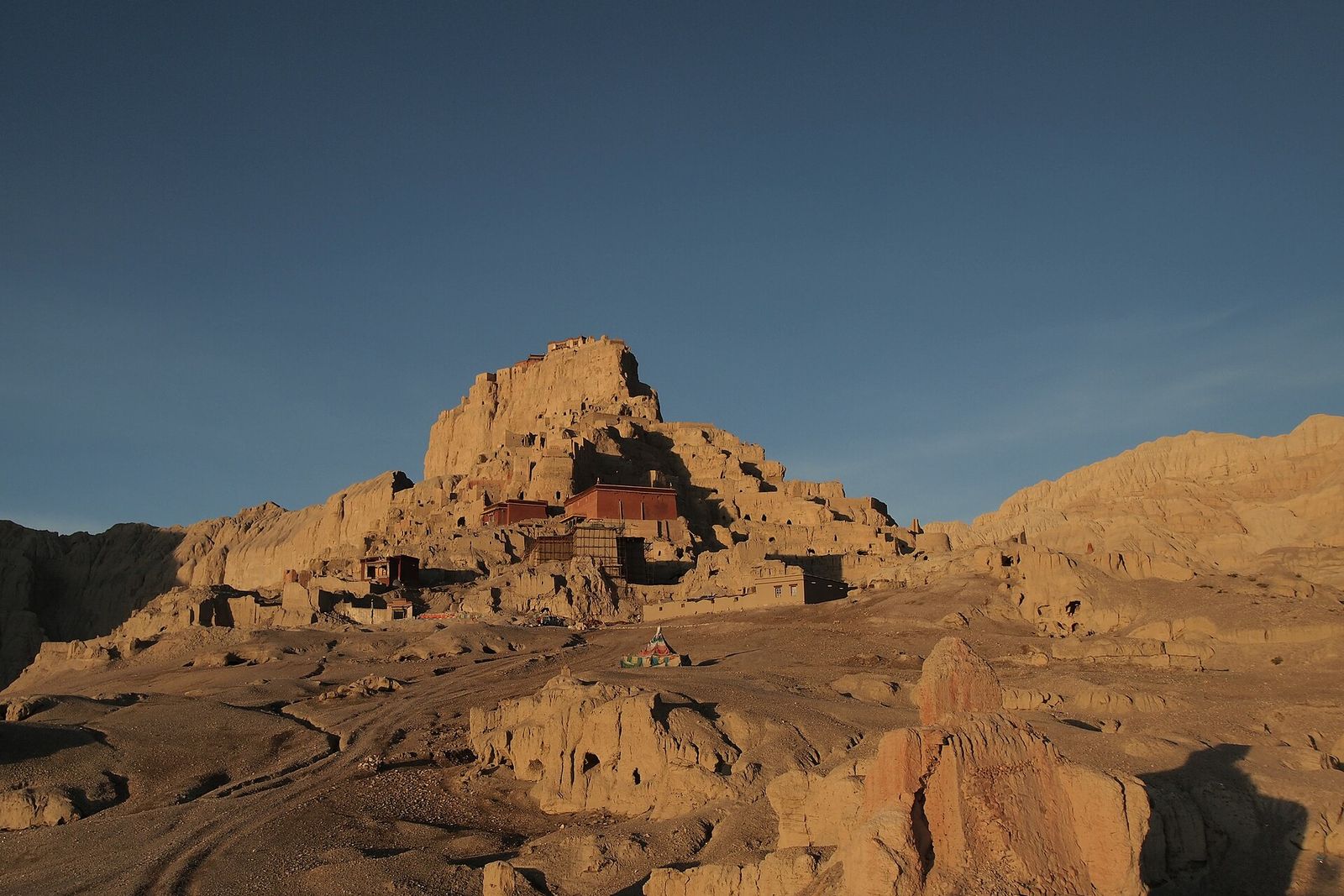
Guge ruled western Tibet from the tenth century and cut its capital at Tsaparang into an earth ridge: hundreds of rooms, tunnels and chapels stacked up a cliff, with murals still on the walls. The kingdom ended in the seventeenth century.
Tholing was founded in 996 under Guge patronage, and the translator Rinchen Zangpo and later Atisha worked from here. The re-establishment of Buddhist scholarship in Tibet ran through this valley before it reached the centre.
Manasarovar is freshwater and circumambulated; Rakshastal beside it is salt and is not. They sit a few kilometres apart below Kailash and are separated by a low neck of land that occasionally carries water between them.
See
A near-symmetrical peak with a striped south face, standing clear of the range around it. The south face is what the approach from Darchen gives visitors. It has never been climbed and climbing it is not permitted.
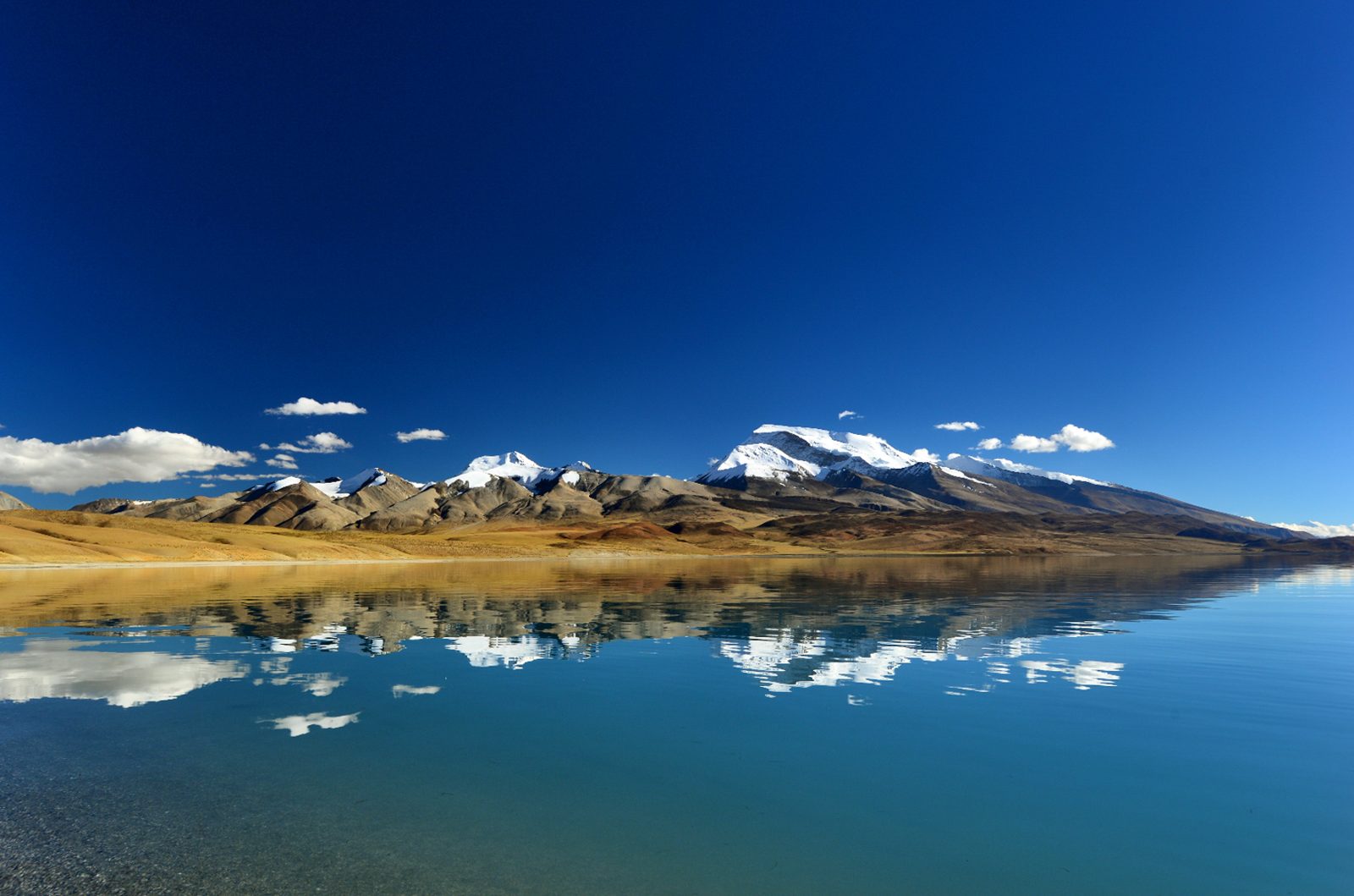
Two large lakes below Kailash, one fresh and one salt, with Gurla Mandhata standing over them. Monasteries and guesthouses sit on the Manasarovar shore and a road runs much of the way round. Bathing is a pilgrimage act here, not a swim.
A whole capital cut into and built onto an earth ridge at Zanda: cave dwellings, tunnels, defensive works and chapels whose murals survive. Photography inside the chapels is prohibited. Allow half a day and take a torch.
Founded in 996 in the Zanda valley, with surviving murals in the main halls and a long line of chortens beside it. Much was damaged and what remains is protected. It is in Zanda town and is the natural pair with Tsaparang.
Hundreds of square kilometres of eroded lake-bed clay standing in towers and walls along the Sutlej valley, which is the landscape Guge was built into. The road from Darchen to Zanda runs through it and the last hour is the ideal of it.
Pecked figures of yaks, hunters, riders and symbols on boulders across Rutog county, some of them thousands of years old. They are scattered and unfenced; a local guide is the solely practical way to find the good panels.
On the Map
Approximate locations of the attractions above, across Ngari.
Eat
Yak hung to dry in air this thin and cold that it needs no salt, eaten in slivers or softened in tea. It is what travels well here, which matters in a prefecture where the distances between towns are measured in days.
Roasted barley flour kneaded with butter tea in the bowl, which is the plateau staple and, at this altitude, often the sole thing cooked in a guesthouse. It needs no fire and it digests easily when visitors are short of oxygen.
The market at Burang near the Nepali and Indian borders carries goods brought over the passes: spices, cloth, brass, dried fruit. It has worked this way for centuries and it is the sole place in the prefecture where the food is not local.
Restaurants in Darchen, Zanda and Shiquanhe are mostly Sichuan-run and serve stir-fries a long way from Chengdu. Cooking takes longer because water boils low, and fresh vegetables are whatever came up the road that week.
Do
Three days, 52 kilometres, and a pass at 5,630 metres on day two. Spend several days above 4,000 metres before starting. Horses and porters are hired at Darchen. Turn back if headache becomes confusion or breathlessness at rest.
The chapels are unlit and the murals are the reason to be there. Photography inside is prohibited and enforced. The climb through the tunnels to the summit chapels is steep and the drop at the top is unguarded.
The last stretch into Zanda drops through the earth forest and the low sun puts the colour into it. Timing the drive for late afternoon costs nothing and turns a transfer into the ideal hour of the trip.
Ngari needs a Tibet Travel Permit, an alien travel permit and a military permit, all arranged through a licensed operator weeks in advance. Checkpoints are frequent and thorough. There is no way to do this prefecture on one's own.
When
Passes open, weather relatively settled and the kora walkable. The main season, with the Saga Dawa gathering at Darchen in the fourth lunar month.
Warmest and wettest, with the Sutlej road subject to washouts and the mountain often in cloud. Indian pilgrim groups come through in this window.
Clear, cold and the ideal mountain views of the year. The other good window and the quieter one; the kora gets hard as the nights drop.
Snow closes the passes and the kora is not walked. Temperatures are severe and permits are difficult. Not a season to attempt this prefecture.
Explore More
Ngari is in Tibet, in Southwest China.
Themes with places in Ngari
Related
Share the travel dates and interests, and PreeChina's local team will design a route that fits.
Plan My Trip to NgariSee Private Tour Prices